Wednesday, September 30, 2015

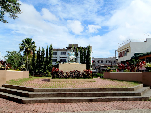
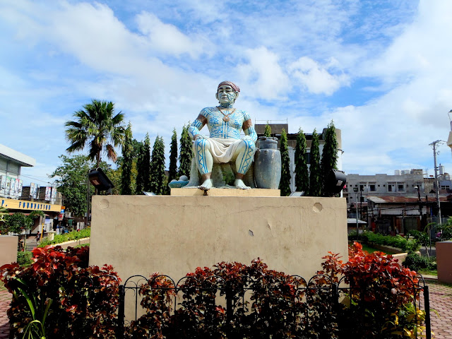
Rajah Humabon Monument

Rajah Humabon Monument
This is my second destination in Going Back to the History of Cebu

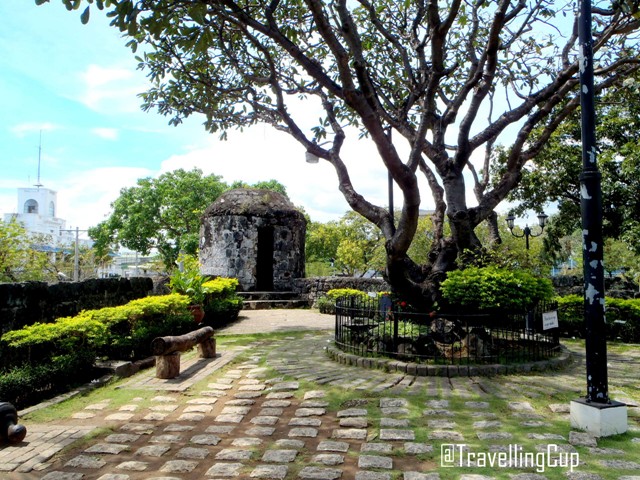
Right after the Cebu Metropolitan Cathedral, as instructed by the cathedral's caretaker, just few steps crossing the high way, I found this plaza that answered my question: "Who was the first Christian in the Philippines?"  The plaza is beside the intersection, and in the middle of the high way.  It's an open space and like a typical park in the country.  There were some trees, flowers, grass and the landscape are really beautiful. 

Rajah Humabon also known as Rajah Hamabar was the Rajah or  a leader of Zubu (now Cebu) during Ferdinand Magellan's exploration in the Philippines in 1521.   According to the writings on the marble plate that can be found in Plaza Hamabar Marker: Rajah Humabon was the first Filipino chieftain to embrace Christianity.  Regraded as the wisest and bravest man in the island.  When Ferdinand Magellan landed on Cebu on Sunday, April 7, 1521, Rajah Humabon made a blood compact with Magellan as a symbol of their new found friendship.  Captivated by its noble teachings, Rajah Humabon was converted into Christianity.

On Sunday Morning, April 14, 1521, Humabon as his wife, Humamai and about 800 Cebuano's were baptized.  Humabon was given the name Carlos in honor of King Charles V of Spain and his wife Queen Juana after King Charle's mother.
Rajah Humabon
In remembrance of the occasion, Magellan gave Queen Juana an image of the child Jesus as a gift.  While a large cross was erected to mark the Baptismal.

Well, after reading what's written on the marble, everything was crystal clear in my mind.  I was able to answer my own question.  Since the plaza is an open space, some vendors were there selling their products.   But, at the rear part of the part, while reading what's written on the plate, there was an old lady washing her clothes and was trying to solicit a money from me.  She told me that she needing 900 pesos to go home somewhere in south Cebu, unfortunately I wasn't help her.  First thing, I don't know if she's saying the truth or not, secondly it's not a part of my travel budget.  I just said "Goodbye" to her.  Next time that I will be going to encounter such, I will refer them to DSWD, I am a traveller not a politician, hehehe.

Anyways, just beside the park, you can find Cebu Cathedral Museum which contains a lot of memorabilia from the past Archbishop of Cebu.

Tuesday, September 29, 2015

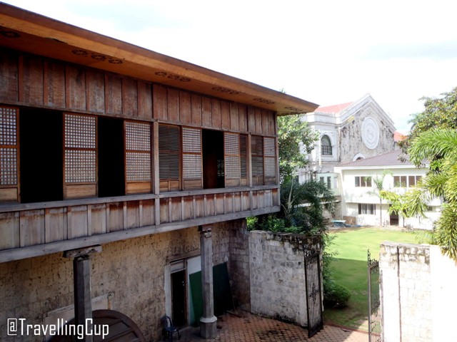
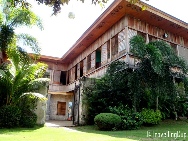
Cebu Cathedral Museum

Cebu Cathedral Museum
This was my third destination in Going Back to the History of Cebu

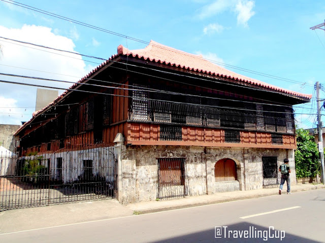
Just beside the Rajah Humabon Monument, Cebu Metropolitan Cathedral and along the high way, I found an old house with capiz windows and wood as the walls.  When I've checked my map, beside the monument is the Cebu Cathedral Museum, so no need to walk farther.

Just seven steps from the plaza (I counted it) is the entrance of the museum.  It was so early, so the janitor was still cleaning the floor when I arrived at the lobby area.  The caretaker and the guard were so kind to me.  A beautiful and young woman at heart was sitting at the reception area that time,  and she was giving me an instructions about the policies of the museum (like no picture taking on the second floor and chapel.)  She was smiling the whole time while she was giving me the receipt and giving me some information about the museum.  Entrance Fee: 50 Pesos

Right after processing my entrance fee, I followed what she instructed me.  I stepped on the old wooden staircase that has no nails used during the construction.  The stairs is going to the second floor that contains a lot of memorabilia and galleries from the past Bishops.
Cebu Cathedral Museum
The first gallery contains photographs that is showing how the Catholic grew in Cebu.  On the second gallery is the collection of memorabilia of His Eminence Ricardo J. Cardinal Vidal like religious books, the vestments worn during his Episcopal ordination, ring from his predecessor Julio Cardinal Rosales and some golden and silver coins ( I don't know what it symbolizes.)  The fourth gallery contains different saints which are from different private individuals.  The fifth has a collections of religious chalices, ciboriums, cruets, monstrances and vestments.  There were still a lot of tiny pieces which I have no idea what are those.

Papal Mobile John Paul
On the side of the museum, you can find the Mercedez Benz being used during the parade of the late Pope John Paul II on 1995 during the World Youth Day.

Cebu Cathedral Museum is an ecclesiastical museum of the Archdiocese of Cebu.  The building itself doesn't have any exact details during the constructions because the archdiocesan archives were burned along with the Cathedral and the Archbishop's Palace during the trial bombing of the U.S. forces in September 1944.  But according to some historical people, it was built by Bishop Santos Gomez Marañon during mid-1800s.  Bishop Marañon was known as a church builder.  He designed the Metropolitan Cathedral and other religious structures in the province of Cebu.

The structure of the museum is an example of bahay-na-bato and was based on bahay kubo architecture.  The materials like bamboo and sawali were perfectly created and decorated for the walls; hardwood trunks for the posts; Capiz shells for the wide windows. 

The ambiance inside this heritage house was really good.  I can feel how fortunate the Cebuanos are, in terms of their own history.  But, I still need to proceed to my next destination, so time to say good bye to the people of the Museum.  Next was Cebu Heritage Monument.

Monday, September 28, 2015

Colon Street

Colon Street
This is my Fourth Destination in Going Back to the History of Cebu

After my tour in Cebu Cathedral Museum, I showed my map to the receptionist if what's the nearest destination in my list and what street I'll take and they responded appropriately.  So from the museum, I was walking on the side going to my next destination when I saw a familiar obelisk in the intersection along Colon Street, I think it's a hundred meters from the museum.

Colon street is said to be oldest street and shortest road in the Philippines.  It was name after Christopher Columbus who bears different names (Spanish: Cristobal Colon, Italian: Cristoforo Colombo, Protuguese: Cristovao Colombo.)  It was established by the Spanish arrived in Cebu in 1565, led by Miguel Lopez de Legazpi (a Spanish conquistador.)  The local government erected Colon Monument in the intersection of the street.

Along this street are commercial centers and shops, catering different services.  When I conducted some short research about this place, I knew that this street serves as the home of prostitutes.  According to the residents, there were a lot of old houses along the street, which looks like Calle Crisologo in Vigan, Ilocos Sur few decades ago.  But now, I didn't see anything that deals with the history.

Sunday, September 27, 2015

Heritage of Cebu Monument

Heritage of Cebu Monument
This is my Fifth destination in Going Back to the History of Cebu

While I was in the taxi going to Colon Street for my breakfast, I saw a monument at the left side which looks like so familiar, and when I asked the driver if what was that, he answered: "It's Cebu Heritage Monument."  when I heard that name, I easily grabbed my list and that's it! it's included in my List to Visit.

Heritage of Cebu Monument is situated at the original Plaza Parian.  It occupies a triangular portion near the end of Colon Street.  This Monument showcases the significance and symbolic events in history of Cebu during the reign of Rajah Humabon.  It was a work of art by the National Artist Edgardo Castrillo on July 1997 in cooperation with Mayor Alvin Garcia and was inaugurated in December 8, 2000.

The fund being used for the construction of this gorgeous monument came from the donations of some private individuals and organizations.  The structure is like a compilations of Cebu's Heritage Sites like Basilica del Santo Nino, Cebu Metropolitan Cathedral, Saint John the Baptist Church, Magellan's Cross and a Spanish Galleon.

Heritage of Cebu Monument
According to The Freeman, during the excavation of the monument's foundation, some artifacts like skeletons, stone wares, plates and jars were dug out.  So, those artifacts served as a proof that before the arrival of Ferdinand Magellan - the discoverer of the Philippines in 1521, the locals already developed their own civilizations.

Heritage of Cebu Monument
Today, this monument is surrounded by some commercial establishments and residential areas.  Just few steps from the main entrance, the basketball court and Pari-an Fire Station, which is one of the oldest existing fire station in the country and the Chapel of San Juan Bautista can be found.  This monument is very accessible and every Cebuanos knew about this place, so if you're going to this site alone, no need to worry about the right way.  I was in this spot for less than 20 minutes because the sun was really hot that time, so I decided to proceed to Yap-Sandiego Ancestral House.

Saturday, September 26, 2015

Fort San Pedro

Fort San Pedro
This was my twelfth destination in Going Back to the History of Cebu.

After Magellans Cross and Basilica Minore del Santo Niño, I took a short break at the convenience store nearby.  After an hour rest, I left that store and proceeded to Plaza Independencia which Fort San Pedro is situated. Fuerza de San Pedro is a military defense structure built by the Spanish and locals of Cebu under Miguel Lopez de Legazpi's (Spanish conquistador) command, but the date of the construction wasn't sure.  There were claims that Jesuit Antonio Campioni built the fort in 1630.  But, there were a lot of major renovations in the 19th century for the structural improvements of Cebu.

Fort San Pedro
Its main purpose is the same as Fort Santiago in Manila - it was used to repulse the Muslim raiders. It served as a strong wall and protected the Filipino revolutionaries.  There were major renovations done in this site in 19th century as part of the structural improvements of Cebu City.

Fort San Pedro
It has a total area of 2,025 square meters.  The walls are measured 20 feet high, 8 feet thick and the towers are 30 feet from the ground.  The walls are made from coral stones, so during the renovations in 19th century, the laborers hauled the stones under the sea of Cebu coastal shores just for this renovations.  The stones were cut and polished according to the appearance of the original stones on the wall to make it balance.

Fort San Pedro
Since the fort is triangular in shape, it contains three bastions; in South West - La Concepcion; in South East - Ignacio de Loyola and in North East - San Miguel.  Each of the sides are unequal in lengths, then the side facing the land has the main entrance which contains some of the paintings, old pictures, newspapers and the black and white pictures of the people who served as the leader of this wall and in the province.

This area is under the management of Department of Tourism and with the local government, as they're trying their best to promote Fort San Pedro as part of their History.  You need to include this site if you're visiting Cebu City.

Friday, September 25, 2015

Basilica Minore del Sto. Niño

Basilica Minore del Sto. Niño
This was my tenth destination in Going Back to the History of Cebu
At the back Magellan's Cross I found the entrance going to the one of the oldest catholic churches in the country and the home of Sinulog Festival.  There were shops and food court near its gate.  There were guards who's checking backpacks and luggage for security purposes.  A lot of people were here that day, even though there was no special occasion. 

Basilica Minore del Sto. Niño
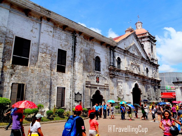
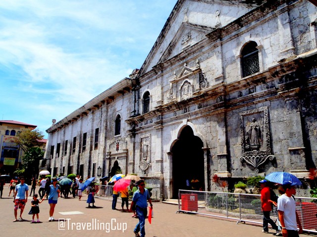
Basilica Minore del Santo Niño or Minor Basilica of the Holy Child is one of the minor basilicas in Cebu City.  This is the oldest Roman Catholic church in the country built in the same spot where the image of Santo Niño was found in 1565 by Spanish explorers led by Miguel Lopez de Legazpi.  This statue is the same with the statue given by Ferdinand Magellan to the wife of Rajah Humabon, 44 years later, as a gift during their baptism on April 14, 1521 at the exact location of Magellan's Cross today.

Basilica Minore del Sto. Niño
This church was founded by Rev. Andres de Urdanera on April 28, 1565.  The very first church structure was made from hard wood and nipa but it was burned down in November 1, 1566.  Thirty years later, 1605, the replacement of this church was started by Rev. Pedro Torres and was completed in 1626.  But, it was again destroyed by fire in March 1628.  The next structure was built immediately, using stone and bricks, by Rev. Juan de Medina, but it was stopped due to the low quality of bricks being used.


Basilica Minore del Sto. NiñoThe foundation of this church was started on February 29, 1735 by Father Provincial Bergaño, Governor-General Fernando Valdes, Bishop Manuel Antonio Decio y Ocampo and Rev. Juan de Albarran who designed the structure.  The church that we can see today  is made from hard stones ordered by Fernando Valdes y Tamon.  This church was built in the same spot where the previous church stood and was completed in 1739-1740.

Basilica Minore del Sto. Niño
In September 1990, the friday masses were moved into the Pilgrim Center (photo above) to accommodate more people.  This is an open theater located in front of the basilica.  It can accommodate about 3,500 devotees at a time during masses or large festivities.  Another place that can be found in the Basilica Complex, at the rear portion of the Pilgrim Center is the Museum.  It houses the history of Christianity in the Philippines.  Some historical and religious artifacts like the images of Santo Niño, antique relics, furniture's, glasses, vestments and etc. used by the former catholic leaders can be found. 

I didn't enter the church because too many people were staying at the entrance, so I was there for just about thirty minutes, then I went back to Magellan's Cross.  I asked the two policemen on duty in front of Cebu City Hall if where's the way going to Fort San Pedro - which is my next destination.

Thursday, September 24, 2015

Yap-Sandiego Ancestral House

Yap Sandiego Ancestral House
This was my Sixth destination in Going Back to the History of Cebu

This house is more than ten meters from Cebu Heritage Monument and less than a hundred meters from Colon Street.  This structure can easily be recognized because of it's unique appearance.  At first, when I saw this house, I was excited but I felt different which I couldn't explain that time, maybe because of the structure itself.

This house was originally owned by Chinese merchant, Don Juan Yap and Doña Maria Florido.  It is one of the oldest residential house in the Philippines.  It was built between 1675-1700 and was made from Coral stones, used egg whites as glue and "Tigas" or clay for the roof.  The wooden pats of the house were made of "balayong" and "tugas" or molave which is the hardest woods in the country. 

I paid 50 pesos for the entrance fee, then proceeded inside the old house.  First thing that I recognized was the table and the chairs which were all antiques, then I saw the ceiling of the ground floor (which is supposedly the floor of the second floor.)  The woods being used in this house already have some molds and stains which looks like really old.  I felt afraid when I was on the staircase, because the woods that I was stepping on to were creating a sound like it will be broken.  But, everything was fine, maybe that's the effect of being old? I don't know.  Please refer to the photos below and see how a real antiques look like.
Yap Sandiego Ancestral House
Cebu History
If you will see the photos above, everything in this house were all antiques except the fridge and the air conditioner.  From the kitchen wares, everything in living room and the rest were all antiques and were part of the life of the owner of this house.  According to the guide inside this house, the 8th generation family were now the owner of this old house and every weekends, they are resting in this house together with other family members.  Beside the house itself, I found a mini garden which all are green except the woods.  But, look at the photos below which were taken at the garden.  Try to identify the difference between the color of my shirt and the background.  

Yap Sandiego Ancestral House
In this garden, there is a 14 feet well which is filled with fresh water, but it's not a potable one.  There are jars, bonsai, chairs and the banca or a boat (photo above) which serves as the flower pot underneath the window frame.  Also, the guide added, this house is situated few meters (at the back) from the river, that's the use of the banca before.  I also noticed that some of the antiques can be found on the second floor maybe because they were afraid on the flood?  That's just some of my question, because the guide told me that this house was flooded every rainy days, few years ago.  After the amazing tour in the antique house, time for another antique invasion in Casa Gorordo Museum.

Wednesday, September 23, 2015

Magellan's Cross

Magellans Cross
 This was my eight destination in Going Back to the History of Cebu

After my early lunch in a food stall near Casa Gorordo Museum, I proceeded to my next destination which is the Magellan's Cross. This itinerary was the one that the receptionist in Cebu Cathedral Museum  shared to me, so I followed it.  From the museum, I walked more than 400 meters going to this spot.  There were jeepneys passing the same highway, but I chose to walk to discover new things along the way.

Cebu Historical Places
I asked the people if where's the right way going to this site and they were so kind to me.  I didn't use my map because it's more complicated and I don't want to stare on the map while walking on the sidewalk.  Before I reached the cross, I passed by the gate of Santo Niño Museum.  I tried to enter that gate, but the guards didn't allow me, instead, they instructed me to enter on the entrance beside the rotunda of the cross.Magellan's Cross is Christian cross made up of wood erected by Ferdinand Magellan (a Portuguese explorer) during his exploration in Cebu, Philippines on April 21, 1521.  This cross can be found inside an octagonal chapel in front of Cebu City Hall and beside Basilica Minore del Santo Niño.  This one of the most prominent tourist spot in Cebu and Philippines.  But, the cross that you can see today is a tindalo wood where the splinters of the original Magellan's Cross were encased.  The wood of the original cross were deteriorated because the people were chipping some parts and making it as a souvenir in the belief that it's miraculous.

Magellans Cross Cebu
The chapel of this cross is made from stone and was built in 1841.  Then the new cross encasing the splinters of the old cross was established in 1845.  This exact location was the place where Cebu's Rajah Humabon, his wife Juana and 800 followers were baptized on April 14, 1521 and that was the very first Catholic mass in the Philippines.  The ceiling of the chapel shows how Magellan instructed the local laborers building this structure.  It also contains an image on how the people of Cebu was converted into Christianity.  Then, beside this chapel, another heritage site can be found - it's Basilica Minore del Santo Niño

Tuesday, September 22, 2015

Casa Gorordo Museum

Casa Gorordo Museum
This was my seventh destination in Going Back to the History of Cebu

When I am done with Yap-Sandiego Ancestral House this house was my next destination.  There's a huge difference between this two heritage houses in terms of it's architectural structure.  This Gorordo House shows how a prominent family lived during their generations.  From the floor, artistic walls, windows up to the roof top - it's really gorgeous. 

At the main entrance of this house, it's historical background was written and here's what it says: "This house was built in the mid-19th century by Alejandro Reynes y Rosales and was bought by Juan Isidro de Gorordo, a spanish merchant, in 1863.  Four generations of the Gorordo family lived in this house, including Juan Gorordo, first Filipino Bishop of Cebu, 1910-1932.

Acquired in 1980 by the Ramon Aboitiz Foundation Inc.  It was restored and later opened as a public Museum.  Casa Gorordo has been declared a National Historical Landmark by Virtue of National Historical Institute Board Resolution No. 4, dated September 24, 1991." - courtesy of Casa Horordo Museum
Casa Gorordo Museum
The Guest Room - this room features a four-post bed with a canopy, an old aparador (closet), an armario (pillow rack) and lavador with porcelain basin.  The guest room was rarely unoccupied as, like other Filipino families, the Gorordos regularly hosted friends and relatives. - courtesy of Casa Horordo Museum

Photos above and below were taken at the Kitchen
This is a reconstruction of a traditional Cebuano kitchen which was used by the Gorordo household.  Typically, the kitchen was located in a separate hut because of the smoke it produced and as the precaution against fire.  Objects found in this house include ceramics, wooden utensils, glassware and cooking implements from the 1800s and the early 1900s.  Other interesting features are the earth-paved stove or abuhan, the food cabinet or paminggalan and the dish dryer or banggera extending from the window. - courtesy of Casa Horordo Museum

Photos above and below were taken at the Banyo
A bathroom or baño within the house is a luxury only for few families enjoyed in the 1800s and early 1900.  Same as the common detached baños or the tine, however, those in opulent households had open roof.  This allowed daylight and sometimes, rainwater into the bathroom.  Until the second decade of the twentieth century, water was brought upstairs by servants and stored in big ceramic jars.  The tub was used mainly by women and children.  - courtesy of Casa Horordo Museum

The azotea served many purposes.  In daytime, it was used for washing, drying and ironing clothes.  The cool breeze in the late afternoons and evenings made it an ideal place for relaxation, meriendas and intimate gatherings for friends and family.  The large martavan jars are both functional and decorative.  They are constantly filled with water to cool the breeze that enters the windows.  The whole terrace is shaded by two flowering vines; the yellow bells and the bridal bouquet, the latter being almost as old as the house. - courtesy of Casa Horordo Museum

After the exit of this heritage site, I took my early lunch nearby.  For only 60 pesos, I already had plain rice, soda and the delicious fish.  I stayed there for 30 minutes then proceeded to Magellan's Cross.

Wednesday, September 16, 2015

Mt. Mantalingajan Traverse

Mt. Mantalingajan
Photo Above: Mt. Mantalingajan is at the back of that ranges.
Mt. Mantalingajan is situated in Rizal, Palawan with more than 4 hours travel from Puerto Princesa City. Manta (another name given) also got the 9/9 rating in terms of its difficulty. According to some sources, it is the combination of Mt. Halcon of Mindoro and Mt.Guiting-guiting in Romblon. So, to complete my MIMAROPAs Big 3, I want to conquer myself on the trails of Mt. Mantalingajan.

Early June 2013, I already booked a Piso fare from CebuPac just for this climb. And to give you a heads-up, this is actually my first climb that includes airplane as part of the transportation. But unfortunately, I encountered a problem during my flight. Here’s what happened: few days before my flight, I was really busy and tired because I did some auditions, including Pinoy Big Brother and other teleseryes. So, the night before my flight date, I slept for about 9 hours and forgot to set an alarm. So in short -> I was late on my flight. I tried negotiating with the airline staff, but it was negative.

Since, I was already in the airport; I have no choice but to buy a new flight ticket. After buying the ticket, I waited at the airport for 9 hours for my flight and stayed there the whole time because I was afraid to be late. Supposedly, my plan for January 21 is to do a walking city tour then buy supplies at the supermarket, but that plan disappeared.

It was passed 7PM when we arrived at the Puerto Princesa Airport, chartered a tricycle going to our lodging house near the highway and did some final preparation (foods and packing) for the climb the next day. 

Day 0 – January 22, 2014

Since we already have contact for our transportation going to Rizal; early in the morning, the driver and his 16 sitters van arrived at the lodging house. Loaded our huge backpacks in the van then proceeded to the lodging house of the other participants. There were 10 participants in total for this Manta climb.

After participants’ intro, the driver began driving along a concrete highway with narra trees on both sides and it was like a scene in a Koreanovela. I noticed that the highways of Puerto Princesa are much cleaner than the other places I visited.

 Our first stop over was 8AM at Babes R. Fastfood along the highway. This is one of the major stop over location. We ate our late breakfast and bought our packed lunch as well. Comfort rooms are also available at the rear side of the resto.

Next stop - 8:24AM, at the wet market where we bought our supplies, trail foods and etc. Then, at 11:25AM, where we all went to the comfort room at the Pamilihang Bayan ng Jose P. Rizal. I saw the people starring at me when I get off the van, I don't know why.

The whole journey while we were heading to the jump off was cool. All the participants have a chance knowing the others while in the van. I heard laughters, new ideas, different stories and what's not. After the long and smooth drive on the concrete roads; there were parts where the roads were under constructions.

Since we chartered the van going to Rizal, the driver brought us to the nearest point going to Balin-Balin village. At around 12:30PM, we got off the van then changed our outfit. Instead of using short sleeve shirt, I used my red long sleeve as protection for the sun UV rays and mosquitoes as well.

It was a warm noon time and the sun was shining brightly. After few meters of walking along the road; the sticky brown mud mixed with water was overflowing. It almost scattered everywhere which made our shoes dirty.
Photo Above: Balin-Balin Village. We met the guide and the porters in this cute village. We also took our lunch, cooked some foods and packed everything in our backpacks.  The ambiance here was stunning and cool; as the cottages were made from wood, bamboos and nipa. The houses of the locals are few meters from each other.

We started trekking on the muddy trail at around 2:18PM. Look at the photo on the right, can you identify if where are the safe spots? And who's that man trying to do something else just reach the summit with clean shoes? It was really a long muddy trail.

Aside from the muddy trail, we also crossed four rivers on the first part. I was getting a hard time in ascending this mountain. My knees were both shaking that time, I encountered difficulty in breathing which are very unusual. Good thing that I was able to handle that feeling.

There were parts of the trail where it was almost an assault, so I took a lot of five minutes rest. 3:45PM, we reached Mamamahin where the Manguis tree (locals call in Ginoo) is located. This tree is said to be the tallest tree in the country. In this part, we heard the Taaw't Bato tribe doing their Tabad Celebration or the wine ceremony. It is a ceremony which the residents were drinking a wine from a fermented honey. I was hearing sounds from bass drums, metals, sticks and people were shouting and singing in an ethnic tune.


After taking a long rest at Mamamahin, we continued ascending on the trail. The rains started dropping from the sky, the wind became colder and the darkness started embracing the trail. The same thing, the trail was still muddy and it's getting worst because of the rain drops. There were residents who showed hospitality to us every time we have questions about the trails. There were no trails marks, like ribbons tied on the trees.

We reached Magtangob or Sir Buldog's house at 5:41PM. Our shoes, pants, shirts, bags were all have mud stains. After putting our backpack on the ground, we easily ordered buko from Sir Buldog. The coconut juice and meat both have a good taste and my energy went back. Water source is just few steps from the house. Instead of pitching tents, we occupied the house's open space. When the group was complete, prepare our dinner, then socials and took a rest.

Day 1 - January 23, 2014

Early in the morning, the wind was cold while preparing for our breakfast and then packed our lunch. Prepared our stuff while eating our breakfast. 6:45AM, we left Sir Buldog's house and resumed trekking. This part, the main challenge was still the same -> the muddy trail. Our efforts were doubled in every steps. There were some fork trails created by the residents, so it is advisable to be with the guides or porters. Then 8AM we reached Mangamot.

While on the trail, we took our lunch break near the last water source, before Kabwan Community. This time, our backpacks were heavier because we reloaded more water. After lunch, took a short break, then resumed trek. At 12:15PM, we reached Kabwan community or the Camp 1. We stayed here for more than 30 minutes. This area is an open space which can handle 4-5 or more tents. It is also an area which serves as the view deck to see the houses of the natives. According to our guides, this area also served as the landing point of the helicopter of an NGO who tried to spread Christianity and education on the tribe. 1:10PM we reached the Mangkopa area.

The original tribe in Palawan are the Palaw-ans, where the name of the province came from. Another tribe are the Taaw't Bato (photo above) who lives in basic farming and hunting. It is believed that this tribe occupies some parts of southwestern Palawan, including the ranges of Mt. Mantalingajan. Their lifestyle, including their way of dressing is still primitive. Our guides said, these tribe are afraid of thunder and when they saw hikers or other people which are not part of their tribe, they always hide or go to the caves near their area.

According to my sources, these Taaw't Bato and the other natives of Palawan are Pagans, before the arrival of the Muslim and Christian belief. Having said that, upon the arrival of these two main religion, some of the natives went down to the low lying areas and created their own community.

Since we still have ample time, we proceeded to the next camp -> the Kawayanan. Our estimated time of arrival was 2:08PM. We were six (including the porters) who reached this camp. When the rain started dropping, we immediately pitched our tents and prepared dinner. It was a foggy afternoon! Water source is also available in this camp.

When the whole team arrived at the camp site; first thing, they changed outfit first, ate dinner and then the socials. I took a nap then woke up when I heard the remarkable topic, all about Korina Sanchez. hahaha, it was really REMARKABLE!!!! EPIC

Day 2 - January 24, 2014

7:45AM, we left Kawayanan and resumed trek. The trail this time is much much harder because of the long assault. We were all having a FULL PACK, so it was really difficult. 9:50AM, we reached Dikloy-Dikloy which is still part of Ransang, Palawan. It is an open space which everyone has access to see the gorgeous ranges nearby, if there's clearing. We stayed there for less than 30 minutes and enjoyed the relaxing wind blow.

I and one of the porter ascended first and reached the Polanggok area at 10:25AM. This is my favorite part, I enjoyed rock scrambling, hop on and off the boulders, holding on the sharp edges, and seeing the gorgeous bonsai on the area.

I also saw the beautiful ranges nearby while the strong-cool wind blew me. This feature is the same as what the knife edge of Mt. Guiting-guiting in Romblon.

I can suggest to please wear your gloves before leaving Kawayanan, it will be helpful for you. Since I forgot to wear mine, I got bruises and wounds because of the sharp edges. We also passed on the Gunob site.

 After that amazing rocks adventure, we reached Paray-Paray camp site at around 11:25AM. Took a short break then ate our packed lunch. Took a short break again, then pitched our tents. Waited for the arrival of the other participants. 1:45PM we started trekking going to the summit. This time, majority of the trail, we did rock scrambling and hop on/off the boulders.

The photo above shows what's on the trail -> they are all sharp boulders. On the trail, I saw a lot of floras which gives color on the brown and red boulders. The ranges beside Mt. Mantalingajan were all spectacular. The cold wind also made us chill.


 Another part of the trail going to the summit are covered with plants. This time, we stepped on and off the roots which are covered with mosses, ferns and other plants. The soil were wet since the trail is covered with the bonsai-like trees.

At 3:30PM, we finally reached the summit of Mt. Mantalingajan. The photo above shows how gorgeous the summit was. There was a clearing that time, so we have the 360 degrees view of the southern Palawan. The sky was blue and the clouds were all white, there was no sign of bad weather. The wind was cool and totally relaxing. We stayed at the summit for more than 30 minutes. Waited the other participants first before leaving the gorgeous scene.

Mt. Mantalingajan
Left Photo: it's me, Meym with my travellingcup. Photo on the right: another type of a flower which can be found on the cracks of the boulders on the trail. It has a bright red color, with thorns over all its body like a sea urchin. There are some other species of flowers which can be found spread in the area.

Mt. Mantalingajan
 From the summit, I got a problem with left knee because of our Mt. Batulao climb one day before my flight. I already felt this on the first day, but I was able to survived on the pain. I thought everything will be okay since it was already our second day. But, because of the rock scrambling portion, I felt the pain every time I bend my left knee. 5:55PM I arrived at the Paray-Paray.

Mt. Mantalingajan
 The Team - photo by Sir Gofie
Jeff, Pog, Tatay Dinyo, Sadeck, Meym, Gofie, Lester, Jerome, Bong, Drew, Bien, Darlene
(from right to left)
The sunset was stunning with the brilliant orange skies, but unfortunately I wasn't able to capture that gorgeous sunset because I felt tired, my left knee was really painful and the wind was really cold -> in short tinamad lang naman ako. Prepared and ate our dinner, put menthol on my knee and then took a rest. It was a cold night! Water source is just few minutes from Paray-paray.

DAY 3 - January 25, 2014

Since the other group were already awake and was preparing for descend, I went out the tent and feel the cold breeze, as in it was really cold. As what the other participants said, before they slept it was 12 degrees celcious already, so there was a chance that the temperature goes lower in the morning. While chilling, I checked my phones for some unread messages, checked my emails and checked my facebook account.

When all the participants were awake, the same routine, prepared breakfast while having a cup of coffee in my travellingcup, talking about everything under the sun and sharing some personal experiences. When the sun began rising, while preparing for our packed lunch, some were folding the tents and was also preparing for descend. The weather seemed to be great.

We offered prayer and photoshoot before leaving Paray-paray at around 7:48AM. I was hesitant in every step I made on the trail because of my knee. But, I don't have a choice but to start trekking.

Can you guess where is the trail? Doing a Manta traverse was really difficult because of the trail which are not well-established, maybe because of the minimal number of hikers who do traverse. The trail is almost covered with mosses, ferns and other vines.

There were parts where we stepped on and off the roots which are beside the cliff. Walking on this traverse trail is very dangerous. Please be mindful on every steps you made. Since I wore my gloves, it protected me from sharp objects; so no worries in holding to different plants.

There were two visible water sources on this traverse trail, the first is two hours trek from Paray-paray, then the other one is an hour trek from the first water source. After the last water, the trail is still the same thing. The trail is covered with wild vines, tall trees and I was hearing the birds singing. I love the virgin forest of this mountain.

We reached Lapong at around 11:03AM; here, I found the mosses, ferns and other little floras in every corner of the trail. Other creatures like rare earthworms, flowers, insects can also be found on the trail. It just happened that I am seeing the red battery indicator on my camera. The weather was still good and I felt the cold wind.
 
At 11:53AM we reached the landslide area, then ate our lunch in the same area. This time, the area started to be foggy resulting to a colder temperature.

We stayed in this area for 30 minutes, but when Sir Lester arrived, we talked about numbers. We computed the estimated time of arrival to every sites on the trail.

Just to set your expectations, the trail after the landslide is harder than the first part. There are uphill and downhill for most part of the trail and is beside the cliff, the soil and rocks were loose and the thorny plants are present on the trail which can destroy you rain covers and can pull your balance. We also pass on the fork trail to Kamantian, saw the gorgeous formation of Magringgit Range and then passed on Karim.

Before reaching Kawang-kawang at around 3:58PM. 1,190MASL. There were ferns, mosses, cliff hanging and muddy trail. The whole area was covered with fog, but still we saw the beautiful rock formation of Magringgit range from afar. Stayed there for 20  minutes.

We asked the porter/guide if how many minutes would it take going to the next water source or can have a sumptuous buko juice and they answered it's within 40 minutes. So, I already set my expectation for that 40 minutes. But, I noticed we were walking on the trail for more an hour but still we're not seeing any coconut trees.

The muddy and slippery downhill part of the trail was another challenge for us. When we reached the water source, I immediately got my travellingcup attached on my backpack then drunk to quench my thirst. We reached Kupang area at around 6:02AM. We were like zombies walking on the trail, but we had a buko break, our energy was replenished. After that, we gave our remaining trail foods to the family who owns the farm. The weather wasn't fine, the rain started dropping and the darkness almost invade the whole area. Started trekking with our headlamps on.

And the darkness came, rains keep dropping, cold wind was blowing. We were like basang sisiw that time, but still the energy we got from the buko was still there. The trail was getting harder and harder because of the mud and given the fact that it was a downhill. There were no ropes or roots to hold on to, just the cogon leaves beside the trail. I again felt the pain in my left knee every time I fold it, so it was an additional challenge for me. Seeing the lights from afar was my inspiration.

We finally reached the highway of Brgy. Malis, Brooke'spoint, Palawan at around 8:34PM. We were all happy seeing the vehicles passing on the highway and seeing the lights on every houses; those were the proof that we SUCCESSFULLY DID A MT. MANTALINGAJAN TRAVERSE, but still we were thinking of the other half of the team which was still on the trail.  But, after getting an update from them that they will do an emergency camp, everything was fine.

We then proceeded to one of the residents house, a friend of our porter/guide. Put our backpacks on the ground and took a break. Our porter was the one who bought of food for our dinner. Then, Nanay (house owner) prepared the dinning table for our dinner, took a short break, then cleaned ourselves in the bath room with the freezing water. Socials with Bok and his team and finally slept inside the mosquito nets. #probinsyangprobinsyaangpeg. Then, waking up and seeing this gorgeous place (photo above) was remarkable.

 After our 3 days muddy trail adventure, its time to wash my clothes. Early in the morning, I bought bread, coffee and detergent. Breakfast.

The sun was really hot, so right after having a cup of coffee, I proceeded to the faucet at the back of the house and washed my muddy clothes. The other three boys plus the guide and porter went to the market and bought something for our lunch, in preparation for the arrival of the other participants. So inshort -> isa akong plain house wife.

Finally, 1:10PM the remaining participants arrived. That scene was full of amazing stories about our journey. Every participant has their own stories and experiences. It was a reunion! They took a rest and lunch. I went upstairs and took a nap while they were all sharing their stories. When everything was settled, including the porter and guides fee, please refer below:

----------------------------------------
REMINDERS:
For the porter and guide fees; hikers should pay them 5 days (that's the standard) regardless of the completion days (for less than 5 days). PLUS, hikers should handle the fare of the guides/porters as well going back to their respective residences, in Rizal.
----------------------------------------

We left the house at around 4:30PM, our next destination was to find a beach in Brokespoint, Palawan. We took a jeepney going to Brooke'spoint Market (poblacion area.) Travel time was an hour. Bought new supplies for our dinner by the beach; and had a balot and penoy break. Chartered a tricycle going to Sunrise Village, Sitio Paratungon, Brgy. Pangubella, Brooke'spoint, Palawan.

beach in palawan
(Photo above) Camp by the Beach. It was taken at the headquarter of the Bantay Dagat, Paratungon Beach. I might say, this area is a fishermen village because the livelihood of the residents are fishing. Very self explenatory no??? So, kung farming naman ang livelihood, can we call it farmers village? Anyways, it is just 20 minutes from the market.

Prepared seafood for our dinner while the others were pitching their respective tents. There were crabs, tahong (mussel), sea weeds and many more.

So after the sumptuous dinner, took a rest, then cleaned the dishes (nanay na nanay ang peg ko) and time for socials. During our socials, everything was brought up. Took a rest at around 12 midnight (I think.) Others used their tents, and I was at the cottage.

Early in the morning, I saw the sunrise and it was really amazing. The color of the sky was the combination of orange and blue and the horizon was highlighted by the oceans. Took a breakfast while staring of the sunrise.

Mt. Mantalingajan
We then chartered the trike driver going to the terminal of Lexus, Brooke'spoint. Then, we chartered a van going back to Puerto Princesa. The weather was good, the sky was blue while the rice fields were green, mabigla kayo kung yung rice fields yung blue diba? Anyways, the travel period was within 4 hours. Took our lunch break at the same spot. Then the time of arrival in the terminal was at around 1:15PM. Chartered tricycle going to our respective lodging houses.

Upon our arrival at the lodging house, first thing that came in my mind was to take a bathe and it did happened. When were all done with everything, we went to a fastfood along the highway and have a pizza break. Then after that, we walked going to the Baywalk area (photo above.) We witnessed the sunset then stayed there for an hour. After that, I and Da took a tricycle going back to our lodging house. While we were on Manalo street, we saw some of the gorgeous and I think expensive restaurants and hotels along that highway.

At the lodging house, we took a break while watching the news about Vhong Navarro and what's not. At around 8:30PM, we went to KinaBuctch and did a post climb. There were bottles of beers, white and red wines and exotic dishes like crocks sisig and tamilok. It was a night filled with amazing and remarkable experiences. 

New stories and friends were formed and it's time to create a new journey and adventure for the future. I and Sir Jerome were the first leaving the gorgeous Province of Palawan and the rest will still have their city tour.

In general, our Mt. Mantalingajan climb was outstanding. Personally, everything I expected in this climb happened; from the trail class, difficulty and the long trail. It was a remarkable climb with Sir: Sadeck, Jerome, Goffy, Lester, Bong, Drew, Bien, Jeff (organizer) and the muses: Darlene and Meym.

Special thanks to our guide and porter: Tatay, Tirso, Pog and Mata