Saturday, November 7, 2015

Mt. Daraitan | Tinipak River

Mt. Daraitan
Looking for a great adventure near Manila? Or want to leave the stressful life in the Metro? Mount Daraitan and the Tinipak River in Tanay, Rizal should be one in your list. Its adventure is a combination of trekking and camping. In this spot, you can enjoy the natures beauty such as clean river waters, fresh air, unexplored caves and many more.

Usapang biglaang event ba kamo? Ganitong-ganito ang nangyari dito sa Daraitan-Tinipak River event namin, yung tipong kinabukasan na. Panu naman kasi tong si Hanna eh, andaming arte, sabi sa bahay daw nila tapos malaman-laman ko mag-trek pala. No choice, dahil kelangan ko na ding mag-papawis eh. But in general, travelling is already a great adventure.

Mt. Daraitan
Travelling to Daraitan is much challenging then other mountains that we’ve been to, reason? Check the photo above. By the way, we met at Pavilion Mall in crossing. At the rear side of the mall there’s a parking lot for public utility vehicles like jeepneys and FX going to some parts in the Metro. In our case, since feeling mayaman kami nag-FX galore kami for 70 pesos going to Tanay Terminal. Travelling time would be approximately an hour and a half to two hours.  At the rear side of the terminal is the wet market and beside it is the space provided for jeepneys going to Daraitan. NOTE: Punuan ang mga jeep, kaya mas maaga, mas maganda. If you’re searching for something extreme, being ON-TOP of the jeep is an option. Jeepney fare is 70 pesos and travelling time from Tanay to Daraitan is two hours.

Mt. Daraitan
Travelling – is really More Fun in the Philippines. Check the photo on the right. Kung ang peg namin eh “Top Load” si Madam panalo ang peg ay “By the Windshield.” Pero in fairness ang driver nakikita parin ang dinadaanan. Anyways, just to set your expectations, the road to Daraitan isn’t a hundred percent concrete, so expect for  a zigzag and “maalog” while on the road, hirap mag-English.

Epic moment din yung nakita naming sign board, ang sabi “For SALE: Mami with Egg” eh mataba at green minded kami lahat, anu pang aasahan natin sa usapan? Kinuwestyun ko yung naka-sulat, feeling ko kasi mali eh. Panu naman kasi parang mali yung mga phrases eh. “Mami with Egg” daw pero diba dapat diba “Dadi with Egg?” At kelan pa nag-ka-egg si Mami? Aber? Nagets nyo ba? Tawanan lang kami ng tawanan. Kahit pinag-tititigan na kami ng mga tao sa paligid, at pati yung tindera masama na tingin samin.

Tinipak River
4:53 PM, we reached the river. After getting off the jeepney, next part would be the river crossing. Dahil tag-ulan, malalim at malakas ang tubig sa ilog, kaya sumakay kami sa bangka makatawid lang sa ilang metrong ilog. Five pesos ang  bayad. Walang makina ang bangka, kaya manual lang na tinutulak nila kuya ang bangka patawid. Pagkatapos ng bangka, sumakay kami sa tricycle patungong Brfy. Daraitan Hall. Tricycle fare was 10 pesos per head. Travel Time is within 15 minutes.

At the Baranggay Hall, we processed registration and paid 20 pesos per head for the enviromental fee, secured our guide (guide fees: 500-day hike, 750 over night) and did the final packing. Weather wasn't still good yet and we already seeing sun set. So trekking was a challenging one. Ascending took us two hours, including photo ops, tsismisan at of course walang katapusang pakikinig sa mga reklamo at sigaw ni Hanah.

Mt. Daraitan
Finally we reached the camp site. Prepared our dinner and pitched our tent. At dahil basa ang lupa, maputik at umuulan, tinamad na kaming mag-pitch ng tent, kaya sa cottage lang kaming mga boys natulog. Camping style is highly recommended, there's no such thing as fancy facilities. Hikers should bring a tent or rent a cottage. At the camp site, you have a lot of clean water and wash room. Stores are also available, but please don't expect that they'll sell starbucks coffee - if you know what I mean.

The next day, the weather was still in the bad mood. First thing we did was prepared coffee and our breakfast. Tagal din naming nag-antay sa weather na maging okay, but it didn't came. Nakapag-hugas na kami ng mga gamit namin, pati malinis, na-hugasan narin namin pero walang tigil ang pag-buhos ng ulan. Akala namin nung mag-appear yung Rainbow bubuti na, pero hindi parin. So we proceeded to another gorgeous spot.

Mt. Daraitan
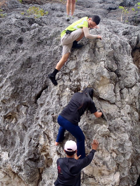
After breakfast at makapag-hugas ng plato, since the weather was already good we proceeded to another part of Tinipak River – seeing the gorgeous rock formations. It’s just few meters from the campsite but the trail is really steep and hikers should take care. Ngayong araw ay maulan, maputik, mabasa at madulas kaya challenging ang pag-baba sa mga bato. Tanging mga improvised ladder na gawa sa mga kahoy  ang kakapitan.

Here are some photos taken by the river:

Tinipak River

Mt. Daraitan

Mt. Daraitan
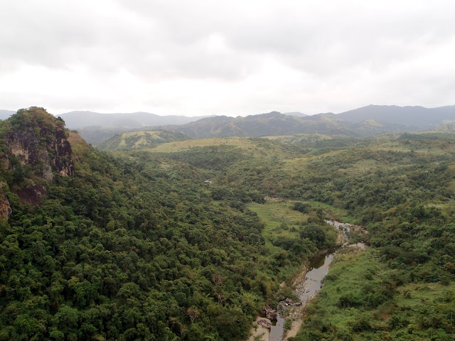
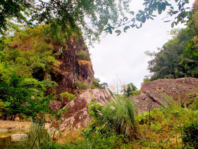
Photo on the right was taken from one point by Tinipak River, as what you can see, limestone rock formation is really good. Ang tubig na umaagos ilog ay malamig, malinis at ang lasgaslas nito’y napaka-relaxing sa aking pandinig.

Mt. Daraitan
Nakakalungkot lang talaga dahil may mga taong walang alam kundi sirain ang natural na ganda ng kalikasan sa pamamagitan ng pag-susulat sa mga ito. Naitanong ko sa aming guide kung sino ang may sala,  sabi nya nilagay daw ito ng mga miyembro ng isang relihiyon o kongregasyon. Well, hindi naman bago sakin ang mga eksenang ganun, dahil sa Mt. Banahaw, Mt. Batulao, at Mt. Maculot marami ring ganito. Sabayan pa ng ibang mga hikers at piknikeers na walang iniisip kundi makakuha lang ng mga magagandang larawan at hindi na inisip ang kalagayan ng kalikasan. Sana maisip ng baranggay na mag-conduct ng simenar sa mga guides.

Mt. Daraitan
We left the area at 1PM. The weather wasn’t fine yet but much better compared during our ascend. This time, we saw the beauty of that area has to offer. Kahit maputik at naiiwan-iwan ang tsinelas ko sa putik okay lang, it’s really worth it! By the way, on the trail there’s a part where locals obliged us to pay for an additional 30 pesos per head for an Environmental Fee. Before leaving the Baranggay Hall in Daraitan, councillors already set our expectations that someone might collect additional fees – so yun na nga sya. Isa pa ito sa mga nag-papa-kulot ng buhok ko eh. Anu to? More FEES, More chances of Winning?

Nagkaroon kaming chance maka-usap ang isa sa mga taong yun, nag-paliwanag naman sya kahit hindi namin tinanong, defensive masyado si Sir diba? Dapat daw, isa lang talaga ang sumisingil ng fee nayun at SILA daw dapat at hindi ang Brgy. Daraitan. Just to give you info, that exact area is already part of General Nakar, province of Quezon, so anu to territorial dispute? Kahit magastos, wala kaming magawa kundi mag-bayad, ginusto namin yun diba; pero ang masakit sa tenga ko, eh yung mag-sasalita sila against one another. Haaayyysss. Ganun talaga pag usapang pera.

Mt. Daraitan 

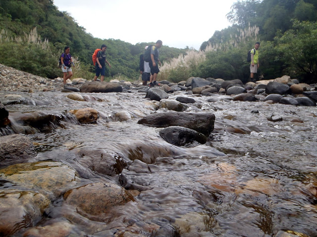
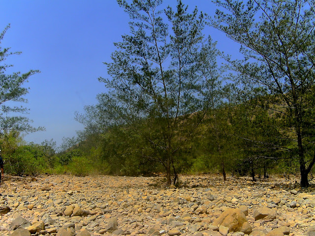
Another part of the trail would be the short distance river crossing and hopping on and off the boulders. So, hikers should be very keen to avoid accident. But according to our guide, every summer these parts wouldn’t be a challenge because the water level is low.

Mt. Daraitan
2PM, we’re already at the Baranggay Hall of Daraitan. At the Baranggay Hall, hikers can take a bath but we opted to do it at LOME House. Natuwa kasi kami sa spelling ng LOME nila, dapat daw LOMI yun, e namali lang daw talaga ang pag-kakasulat, sayang naman effort kaya pinanindigan nalang daw nila. Anyways, aside from shower you can also order lutong bahay – bonga sila Mam no? Nailuluto nila ang bahay? Anyways, before leaving Daraitan, we logged out at the Brgy. Hall first and we were able to met other hikers. Unfortunately, we weren’t able to get the trip back to Tanay, so we waited until 5PM, naki-sakay kami dun sa jeep nung ibang group. In total, there were three groups in that jeep.

 For this event, I spent 500 pesos. With that amount I recommend that you guys try it! The experience we got is pretty much unforgettable.

Friday, November 6, 2015

Mt. Manalmon

Mt. Manalmon
A month ago, Sharon and I planned these year-end special climb for Batang Hamog Mountaineers.  Although, we all know that everyone was really busy preparing for the Christmas Season.  Few weeks after the formal announcement (including the date and location) a lot of the members already created their own activity on that specific date, so as a result, just the two of us will be doing the day trek, so we added a sidetrip going to Giant Lantern Festival in Pampanga as per VP Jerald.


Night before the climb, Jeremy, Franz confirmed that they will be going with us, so everything was settled and we slept happily ever after.  Early in the morning, I texted the three, but Franz replied, Janneth will be with us so, that's it we were five!

HERE'S OUR ADVENTURE DETAILS:
Five-Star Bus Terminal EDSA-Cubao, bus fare is 117pesos. (Cubao to Camias)
Departure: 4:37AM  -  Arrival in Camias: 6:35AM (Total Gas station)
Breakfast  - Hot Gotong Baka with Pandesal just beside the gas station.

From Camias to the Jump Off
Travel Time: 7:14AM to 7:47AM
Tricycle Rental: for 300 pesos, good for 5pax.

8:23AM started trekking
8:26AM reached the Madlum  Cave  where the golden statue of St. Miguel was found - according to history
9:33AM reached the peak of Mt. Manalmon
9:47AM descended
11:00AM reached the base camp then took a long break with snacks and everything
12:00NN reached the small cave
12:52PM reached the Bayukbok Cave
1:45PM reached the base camp and took a rest, lunch and shower

3:45PM Goodbye Mt. Manalmon, Hello Giant Lantern Festival in Pampanga
At the Jump off, rode in a tricycle to Total-Camias for 200 pesos; we were 3 passengers
Took a bus from Total-Camias going to Robinsons - Pulilan for 43pesos (rush hour begins at 5PM, so expect for a heavy traffic)
6:50PM reached Robinsons – Pulilan
Took a short break while waiting for the FX bound for SM Pampanga

7:35PM FX departure and 8:19PM arrival Robinsons Starmills Pampanga (Fx Fare is 60 pesos)
After the Giant Lantern Festival, we went to SM Pampanga, just across Robinsons, to take our dinner, which was around 9:30PM for dinner, I don’t know if it’s too late.

After dinner and rest, we went to Bus Terminal; IMPORTANT REMINDER: that time, there was NO bus passing at the Mall terminal; HERE’S WHAT WE DID: we took a long walk going to Toyota to easily get a bus, but unfortunately  NO BUS AT ALL! So we went back to SM Pampanga in the Jeepney terminal going to Dau Bus Terminal.  This jeepney trip going  Dau is worth 30 pesos for 30 minutes.

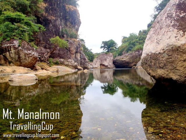
Here are some of the Photos that I can publicly publish.  Starts from crossing the Madlum River to get into the Base Camp.  Remember their was no other security instruments to use in crossing, just your hands holding the cable.  So, if you loose your grip and fell, good luck! you need to use your swimming talent.

Madlum River

madlum caving

Madlum  river crossing

Mt. Gola

madlum river


mulawin

horror stories in Madlum River

history Madlum river
Here are the photos taken during our caving adventure in Madlum Cave and Bayukbok Cave, just few meters from Mt. Manalmon's peak and Base Camp.

Madlum Cave

roped segments madlum river

Caving Madlun River

Bayukbok cave
After the Mt. Manalmon and Caving experience, Here are some photos taken at Robinsons Starmills in Pampanga, for the brief history of this annual event.

Robinsons Pampanga

Giant Lantern festival
And after the stunning festival, we were so hungry, my knees were shaking with the Gangnam Style as the background music, that was around 9:30PM, so we decided to take our too too too late dinner at SM Pampanga, just across the other side highway.

The whole adventure in Bulacan and Pampanga was really perfect.  In one day we were able to fullfill our dream - and that was to have a great climb experience after Mt. Tarak last October.  At least now, we don't need to bring a lot of mountaineering equipments like our tents and everything plus a 3 liters water.  I can suggest Mt. Manalmon to all the first timers, but wants to have a unique experience.

Thursday, November 5, 2015

Mt. Romelo | Buruwisan Falls and the Muddy Trail

Buruwisan Falls
The province of Laguna is lying and is part of the southern Luzon region. This province, together with Batangas and Cavity, is one of the centers for mountaineering activity because of its gorgeous flora and fauna; lke Mt. Romelo which is situated in Siniloan, Laguna. This mountain bears a lot in terms of natural beauty and greatness. Let’s start with the amazing and cool ambiance, refreshing green surroundings, fresh air, and the fantastic lashing waterfalls. 

Mt. Romelo
The trail of Romelo is a long, simple but slippery and muddy because it serves as the trail of the hikers, locals and the animals, like horses and carabaos, which serves as the porters in transporting local products, like fruits and vegetables. The trail is long and composed of fork trails with grasses on the sides. If lost, you can ask the locals if where’s the right way. Its trail type got a 2 rating out of 9 in terms of difficulty.

Buruwisan Falls
Special Feature | If you’re looking for photo perfect background, relax your muscles and swimming on the cool waters in the pool; this is the right spot for you. If you’re also looking for an extreme and challenge, you can try canyoneering, wall climbing and rappelling on the 180 feet Buruwisan Falls, which is located just few meters from the camp site. Few meters from Buruwisan, you’ll find its extension waterfalls, the 70 feet Lanzones Falls. If the pool in Buruwisan is filled with people, then it’s the perfect place for you.

The campsite in Romelo is a wide, clean area near the relaxing river and the waterfalls. The sounds of the lashing waters give a relaxing feeling while taking a rest inside the tent. During our stay here, there was a store in the area but the supplies are limited. If you’re planning to have a porter or tired to walk on the trail to descend, horses are available, just pay the owner.

How to get here? Here’s what we did | We chartered a van going to the Public Market in Famy, Laguna. Rode in a tricycle going to the jump off. Same area, we rode in a van going back to the Metro.

Tuesday, November 3, 2015

Mt. Pundaquit | Trek to Anawangin Cove

Mt. Pundaquit
Last April, after visiting Romblon, Zambales was my next destination according to my planner.  Just one week interval and here we go. . . . Earth Day on Mt. Pundaquit then going to Anawangin Cove. That was my first trek here in Northern Luzon.  After few hours of travel, we've witnessed the real beauty of the province.

Early in the morning, the confirmed attendees met at Victory Liner Cubao - EDSA Southbound.  That was my first time to meet the other members of Batang Hamog Mountaineers.  I already knew some faces, but then this is the first time that I'll be joining them to this extreme adventure.  Anyways, from Victory Liner Cubao, we travel few hours going to Victory Liner Bus terminal (Olongapo City).  Then, waited the other group which will be coming from Baguio City.  So, so save time, while others are waiting for them, we bought everything first at the market, near the terminal with our Gapo Guide, Narayan.  We also took our breakfast in the nearby food chain.

Mt. Pundaquit and Mt. Anawangin is the perfect way to visit Anawangin Cove, well, this is just for  trekking enthusiasts.  While walking on the flat surface in the entrance by the mountain, you can see its gorgeous scenery that awaits to be discovered.  Mountain's entrance is just ten minutes from the shore of Brgy. Pundaquit; the trail passes across grasslands and shrub lands in the area.  On the trail, you will witness the virgin floras that will inspire you!

Mt. Pundaquit
 photo taken on the summit of Mt. Pundaquit
The time I reached the summit, I saw the gorgeous Zambales. From afar, the white sand beache stretches on the shore of San Antonio. The breeze is cool, the air is fresh, the surroundings is covered with green grass and trees, the color of the water changes as the waves running towards the shore.

According to my research, the name Anawangin came from the Ilokano word "nuang" which means carabao and I think that's the reason why I kept seeing Carabao's poops on the trail.  The trail also has river like rocky area, bamboo, trees or even ornamental plants like a garden. 

Mt. Pundaquit
The trail descending from the summit was a bit challenging because my shoes don't have spikes and no other way to control my pace but to descend running, that was few meters. Photo above is a wide river, since it's summer time, no water on this river, you can enjoy walking on the boulders, you can feel the fresh air and green trees around the area.

Anawangin Cove
After the heartaches, skin aches, foot aches and other aches, we finally reached the Final Destination - Anawangin Cove.  It was a tiring day, but when I saw the area, I was amazed! The shore has white sand, crystal clear waters and the breeze was cool, making the ambiance really energetic. Pitched the tents and started socials. In the evening, the people were walking by the beach, having night parties, and night swimming.

What to Bring | Hiking to Pundaquit is a bit challenging because it depends on the season. Be reminded of the following: YOURSELF with confidence, camera, trail water, trail food, sun block, Arm warmer (for summer,) cap or umbrella (during summer.)

Setting your expectations | In Anawangin Cove camp site, there's water source, comfort rooms and shower rooms.  If you want to buy snacks? there's sari-sari store but the price is gold. I suggest, you buy everything first before going to the island.

How to Get Here, Here's what we did | We rode in one of the buses of Victory Liner Cubao (EDSA Southbound) going to Victory Liner Station in Olongapo City, Zambales.  The, we rode in an Ordinary Bus to the Municipal Hall of San Antonio, Zambales. Then, rode in a tricycle going to the shore, travel time was within 15 minutes. Drivers already know the jump off.

Monday, November 2, 2015

Mt. Gulugod Baboy

Mt. Gulugod Baboy
After the Bloggers Climb at Mt. Batulao, where I met the other travel bloggers, this will be the part two plus a post birthday climb for Lonely Travelogue.  We planned it for two months, and we allotted these special dates just for this event.  Mt. Gulugod Baboy and Mt. Pinagbanderahan are both in Batangas.  According to Pinoy Mountaineer, it measures 525+ MASL so it's really perfect for newbie and first timers.  These two ranges has an open a wide space that serves as the camp site.

Our story started at Buendia Bus Terminal where I arrived late.  When I've reached the fast food that was our meeting place, the other participants were already there and waiting for me, even my packed lunch was already prepared.   I didn't asked them what they felt about me - being late!  when I've entered the entrance of the resto, I just said hi and hello then went to the wash room, I badly needed that place that time.  And when I am done, we easily proceeded to the bus terminal, DLTB Transit.

From Buendia to Diversion is 125 pesos for more two and a half hours travel period.  When we arrived at Diversion, we met the other bloggers.  Then we prepared ourselves, distributed our things to the other participants just to be fair.  When everything was settle, we then took a jeep going to PhilPan.  The jeepney terminal is just few meters from the waiting area.  Regular fee for the jeep is 80 pesos, but on our case, we were 9 people, and we had a contract with the driver, for only 600 pesos he will be going drop us at PhilPan, so no need to take a tricycle - and that's it!
Of course we were still together with the regular passengers, so the driver was still following his original route.  Of course we can't forget the " nagmamadali??" portion.  When all the passengers we already with their destinations, time to occupy the whole jeep, so it was one seat apart.  We also bought our water, lighter and brandy for our the birthday celebration and for the socials.

Mt. Gulugod Baboy
Anilao the first diving part being developed here in the country is really great.  We were able to see why this place had been a tourist attraction for diving enthusiasts.  The wind was cool, the sky was blue, the beach and the water were clean, it's really perfect for summer. 

It's almost lunch time when we arrived at PhilPan, first thing we've did was to secure the entrance fee and planned our sidetrip to Sombrero Island.  Kuya, I forget his name, he was very talkative and he knows how to play with the tourists because it's his job.  He was like a walking google, I don't know, because it seemed that he knows everything. 

It was a hot noon time, so we decided to take our lunch there in the cottage then at around 2PM, we'll start ascending. So while having our lunch, we've been talking about everything that just came  into our minds, educational and mostly not.  hahaha.  Picture taking can't be removed in every climb, so we had much time posing and taking photos than walking on the trail.  We were also talking about the history of this place, the how, why, what and where were brought out in every topic, of course kuya can answer it for us.

2PM just ticked on our watches, so time to pack up and time to ascend.  As usual, picture taking before doing our first step to ascend, so therefore, expect for more while on the trail.  It was not a good idea ascending by this time, it was really hot, the sun rays were penetrating our jackets and arm warmer.  I was using my brown umbrella sponsored by my friend, but the rays were still penetrating it, I don't know if the sun was hot that time, or I added the hotness while walking, I really can't conclude, let's ask the others. 

Mt. Gulugod Baboy
It was less than an hour when we've reached our first stop, the area which I saw the cute guy sitting on the bench by the mango tree.  I was wearing my shades that time, so he can't recognize that I was staring to him the whole time.  It was a give and take, because I also noticed him starring on me while I was starring to somewhere else.  I can call myself as assumptionista, but you can't blame me in behaving like this, blame my parents for making me hot like the sun shine.  Just to give you a hint, that was the first stop over, then there was a tarpaulin with Mt. Gulugod Baboy photo and his face was also there.

Okay, let's stop the kalandian portion, after the few minutes rest, we decided to proceed to the next stop over - Naynay Ester's store.  When we arrived at her store, everything was really simple, we were like the son and daughter of Nanay Ester.  She was very accommodating, she even prepared a halo-halo for us, of course it's not for free.  She also informed us about the dogs who act like the thief on the camp site.  I missed Nanay Ester so much! she was like my mother.  But that's only our second stop over, so we needed to proceed to our next stop - another halo-halo store.  We left the store with tears (just adding some drama)

Just few meters away from the store was the entrance trail of Mt. Gulugod Baboy, you can easily notice it because of the board visible to everyone.  After passing near the board, we just started walking the real trail.  The trail was just a simple one, newbie can follow it even without guides.  But the problem that time was really the sun rays, really HOT.  Some parts of the trail were covered with the trees but some were totally open, so sun block is really needed. 

Blogger
Another resident's house who sells halo-halo was our next stop.  Here, we met the other mountaineers while they were taking a short rest.  We bought ice candy and cold ice water, wait . . . is there a hot ice water??  For me, it will depend on the person who's drinking the water . . with pleasure and art!! Anyways, we were there for few minutes, because we were still waiting for the sun set. 

So when the sun was already hiding on the clouds, we begun to take the trail, hoping that the clouds will protect us from sunlight.  But it's just a dream, and it didn't happened, so we kept on taking a rest every time that we saw a tree that can protect us from the harmful UV Rays.  Did you know that UV Rays can damage your skin a lot, and it can make your skin more older looking if you're not using sun block??  At least now, you already know, and another fact, if you're not using a sun glasses, it can also damage the retina of your eyes, so better to use a sun glasses that has a UV protection, all those products are available in super markets, NATIONWIDE . . . don't use SPF for your eyes, okay, it's for your skin! 

The next part of the trail is within the resident's house, so better to say "ola nanay, buenas dias nanay" and you need to have the  accent of Dora - the Explorer.  Remember that we need to have a courteous manner in every mountains that we explore.  Right after saying those words, we proceeded to the next part.

Mt. Gulugod Baboy
The next part was the house being destroyed by . . I don't know.  Look at the picture above.  Just few meters from this location was the house of TatayTatay was also kind, he even informed us about the facts in the area.  We talked about the temperature every BER months in his area.  We also talked about the trail if it's rainy day, so at least we already have the idea about the face of the trail if it's rainy day. According to Tatay, it's few meters more and we'll gonna be reaching the summit.

The whole area has green grass so expect for the cattle pastured just beside the trail.  So if you are scared to the cows, you need to ask tatay to help you.  The next part of the trail was open, but the sun was hiding that time, so we walked hurriedly.  Sharon and I encountered a Y trail, we saw the stone marked on the left side, we knew that it's the correct one, but then we tried to follow the right side, just to explore, and we found out that the two sides were both correct, but the right side part of the trail was longer compared on the left, but the left is steeper than the right side, so your free to select what you want.

Mt. Gulugod Baboy
So right after that challenge, we saw the clean area, with some coco trees that added a great shadow effects in the photos.  The area was very rewarding, after what we've encountered while we were ascending the trail.  This place is perfect for those people who currently experiencing stress in their lives, because the whole area was really stunning.  The cool wind, fresh air, relaxing ambiance - everything was really perfect!  Take note, this is not yet the summit or the camp site, it's just the additional reward for us.

Few meters after this photo was taken, was another rewarding moment.  The whole area was covered with green grass with trees that gives an amazing accent to the view.  In this part we saw Mt. Batulao and Mt. Maculot which were in the nearby villages.  This time, the sun rays were not striking, but it gave a relaxing, golden shadow effects to each of the trees and the contours of the mountain. 

The summit has an amazing 360 degree view of the entire province of Batangas.  The horizon created by the calm sea water and the brilliant blue skies were unforgettable.  Let's give a round of applause because the clouds were playing with us, created different shapes and sizes that amuses us.  Look at the photos below:
Mt. Gulugod Baboy
Mt. Gulugod Baboy
Mt. Gulugod Baboy
The sun set was really beautiful.  Everyone of us were so excited if how will the horizon can create an amazing view while the sun is doing it's sun set.  While on the summit of Mt. Pinagbaderahan, we were taking jump shots, fhm shots and other shorts which I don't know.  The other group also doing the same thing - well we don't care about them, there was a competition going on that time, hahaha. 

The wind that time was strong, so we decided to leave the summit then built our camp site just few meters away from the summit.  Our camp site was clean (except the cow's poops) that added a unique flavor and challenge.  Since the darkness appeared, some of us decided to pitch our tents while the others were still doing their photo shoots.  Here are some of the photos I captured using my phone:

Mt. Gulugod Baboy
Mt. Gulugod Baboy
Mt. Gulugod Baboy
After pitching our tents on the camp site, we cooked our rice for our dinner.  We ensured that our adobo was hot.  While eating, we noticed the group of wolf, I mean dogs, walking around our place.  So we secured everything that they might get from us.  Imagine the movie Twilight then we were vampires doing a camping on the mountain.  When were done in cooking, time to eat . . . . we were so busy, nobody was talking while eating.  Remember the word manners while eating??  That's it!

After eating, of course time for socials and a birthday celebration. It's a brandy party that night, but  the most unforgettable that night was the topics (showbiz chismis, politics, educational and everything)  We also enjoyed the game which until right now, I don't know what was the instructions. hahaha.  That night was full of fog so I decided to wear my blue jacket with orange lining.  We took a sleep at around 2AM - not sure about it.

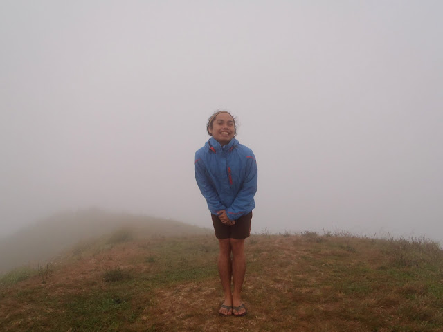
The next day, we woke up at around 5:30AM, while the fog was really thick. After going out my tent, I saw the clouds looks like the Sea of Clouds in Mt. Pulag.  While the sky was orange, the fog was becoming thicker, resulting to a world of fog.  We can't even see the summit, nor Batangas area.  Look at the photos below:

Mt. Gulugod Baboy
Mt. Gulugod Baboy
Mt. Gulugod Baboy
First thing we did was grabbed our cameras to capture that moment.  When we were all awake, we then prepared our breakfast.  Coffee, bread, sausage and everything were prepared for our breakfast.  So again, while eating, we were like reminiscing what happened last night, what we've been talked about. 

After breakfast, we went to the summit again to see if what can we do in there, but same thing, after the orange sun rise for few minutes, the fog just came in and occupied every corner of the mountain.  When we were up on the summit, we didn't see the camp site because of the thick fog.  The scene was like we were inside the ball of fog, which we can only see those things four meters apart from us.

When we went back to the camp site, few minutes of conversation then we decided to breakcamp even the fog was still thick.  So by 8AM, we left the camp site.  There was a group few meters from our camp site, as what I've saw, some plastics were left in their site - which is a NO NO.  That's really frustrating to see that the there are still people who are trying to be mountaineer but doesn't care about nature.  I think we need to have lesson that should develop the minds and hearts of those kind of people.  Before leaving, we prayed first!

Since the ambiance of the mountain was nice, we enjoyed a lot walking on the trail.  The wind was blowing us and seemed like they want us to leave the mountain - so we did.  While we were descending, we also met some other mountaineers who'll be doing a day hike that day.  Descending is more easier because the sun was friendly.

Sombrero Island
We had an hour break at the house of kuya, the talkative kuya we  met the day before, remember him?  In fairness he was very kind to us, he even opened his house for us; we took a bath, used comfort rooms and slept in his house for FREE.  We also prepared for our next adventure which is Sombrero Island.

In going back to the terminal, we took the same jeep, since we had a contract with the driver, same amount, same destination - the terminal.  But before going back to the terminal, we took our dinner first at Bulaluhan nearby.  We had a great experience in this climb.  Everyone of us enjoyed a lot!  This climb will be a remarkable climb for me.  I am hoping for the Part III