Wednesday, March 11, 2015

Mt. Batulao | the Blogger's Climb

Mt. Batulao
The social network Twitter is the only medium which was used to create this Blogger's Climb event.  Why is it special?  For me, it's very special because this event is my first time to meet the people with the same interest as mine - the travel bloggers.  This is the first time that I'll be going to share to some of travel bloggers on what's with mountaineering why I consider it as my "Blogging Inspiration.

Before 2012 ended, we already had the date and the location on where is the best mountain that will be marked as the first Blogger's Climb.  A lot of mountains were being suggested but Mt. Batulao was the crown bearer after the online meetings.  When the places was already fixed, we proceeded with the complicated part - the date.  Since the participants came from different locations and different business fields, getting the right date for this event was a tough decision until we came into January 19 or 20, 2013.  We considered the availability of all the participants, so we've got the January 20, 2013 as the final date, so therefore MARKED!

When everything was fine, and the date was near, so we talked about some preparations that we should have before the climb; and the precautions that we should focus on during the climb.  Good thing that Sir Pao was one of participants, at least he shared a lot in terms of preparations and what to expect.
After my Mt. Cristobal Climb, a week before this climb, I got sore throat and tonsillitis, maybe because of the bacteria and the weather. I met my Doctor, and he said: Iha, may tonsilitis at sore throat ka.  And I answered: What does that mean? He said: Kung anu-ano kasi ang pinapasok mo sa bibig mo eh, Kulang ka lang . . . . . sa kagandahan. That really hurts! hahaha, I am just kidding.  But doc gave me a lot of medicines worth 2,250 pesos.  I informed my Doctor about my climb on Sunday and he advised me to cancel it if I am feeling the same thing, I don't need to force myself, remember Health is Wealth. After dinner I took 3 capsules. Early in the morning, I felt good, everything was fine.

January 20, 2013, 3:45AM - when my alarm rung and I got off my bed, I noticed that I have no fever, and I already have my voice but still my throat aces a bit.  But I can handle myself well this time, Hooray!! I can still climb!  So, I did my morning routine, prepared bread and coffee for my breakfast, then finalized my things inside my backpack.  Inside my backpack are: 2 packs of jelly-ace as trail food, extra shirt and shorts, gloves, arm warmer, personal like sunblock, etc.  While eating, my throat was not ready to swallow solid food, so I suffered pain while eating, I need to force myself to eat, I need energy for the climb.  Good thing that my voice came back, after eating, I took a bath while rehearsing and stretching my vocal chords, so I was singing My All  by Mariah and there were some high notes where I can't reach, so that means, my voice is really not in good condition.

When I arrived at McDo-Taft, Mike was already there and was waiting for me and the rest of the participants.  While waiting for them, I bought 1.5 Liters distilled water as trail water at 7-11.  Next one to arrive is Wewen then we had our breakfast and bought our packed lunch.  As the time goes by, the participants  just increased in numbers until we reached lucky 16 participants. 

Since everything was properly set and everyone already knew each other, the 16 Participants ascended to the bus bound to Evercrest, Nasugbu, Batangas.  Some of the bloggers and the special guests occupied the entrance part of the bus, at the back of the driver, and the 5 BHM (including me) occupied the 5-sitter couch at the end of the bus.  Of course photo shoot will always be a part of any Filipino trip while waiting the bus to leave the terminal.

Evercrest Batangas
8:02AM - the bus left the terminal in Taft.  Now, I can see all the passengers, some were standing, some were eating, some were talking to their plastic friends (sorry judgmental ako eh) and some were sleeping.  But our group, BHM, were busy updating our twitter and facebook and the wireless internet connection was brought to us by @Whab.  Thanks Whab!  BHM is known to be the funniest, happiest and the beautifulest??? mountaineers in town, so as usual, we were so noisy while on the way going to Nasugbu.  The sceneries going to Evercrest was pretty good, we saw different mountain ranges nearby plus the gorgeous hills of Tagaytay City was stunning.  We arrived at Evercrest, Nasugbu, Batangas at 10:00AM and first thing that everyone did was finding the nearest comfort room.  The weather here is really cool, the wind is quite strong resulting the dust to stick on my face.  Another blogger Claire was already there before we descended the bus.  So we were 17 participants joining this enjoying journey. 
Callaruega
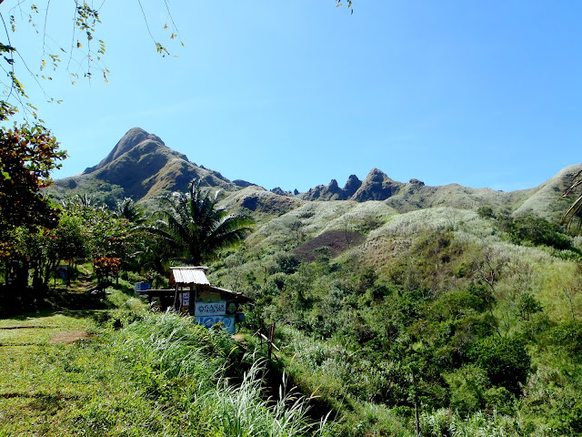
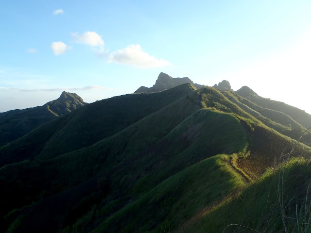
We started walking across the highway entering the gate of the Evercrest at 10:20AM and while walking we saw a lot of people coming form the church nearby.  The road was full of colors while we were walking, we were like rainbows on the road.  Just few meters from the gate, (left side) we easily saw the green and the gorgeous formation of the plantation on the hills (right side) we saw the stunning formation of the mountain ranges including our apple of the eye - Mt. Batulao.  The sun shines brightly but we still felt cold because the wind was really cold.

Mt. Batulao
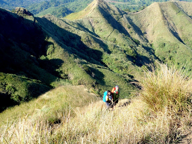
The two members of BHM served as the head, since it was their second time to climb Mt. Batulao.  While ascending higher and higher on the ranges, I've noticed that the sceneries were starting to blow up my mind by its gorgeous formation.  This time, we were taking few kilometers road; some part are cemented and some are not.  The trail going to the Peak of Mt. Batulao are quite simple and easy to follow.  But the most challenging part in taking the trail of this mountain are those dust mixed in the air that can damage our eyes, so I was wearing my sun glass the whole time.  Cogon grasses are always present in every sides of the trail.  Horses are the primary mode of transportation going to some camps and stores on the ranges.  On the way, there were some children offering their services as the guide but not on the summit, just up to the fork meeting the Old and New Trail for 30 pesos per head.  Those children are minors and don't have any protection gears for themselves, so we decided not to get their services.  We are not tolerating illegal and we don't gamble security.

Mt. Batulao
The cogon grass shines like a diamond on the mountain, it dances and just following the direction of the wind.  Some of the pineapple plantations are creating drawing and shapes on the mountain which adds a beautiful pattern.  The head of the sun wasn't a challenge because of the trees which are present beside the trail and the cold wind breezes that made us froze. 

We reached the first store on the trail at 11:50AM, here they sell fresh coconuts for 25 pesos, halo-halo with melon flavor for 25 pesos and some chichiria.  This place is perfect for lunch breaks and for the people to wants to re-energize their tired muscles.  The store are run by a family, so expect for an old and young will serve you.  The owners are really kind to strangers like us.  After we fill our empty stomach, we decided to start following the trail again.

Trail Mt. Batulao
This time, the trail is just in the middle of cliff covered by cogon grass, so we were walking slowly but surely.  12:22PM we've finally reached another store beside the fort trail where the Old and New Trail met.  There were some mountaineers occupying that store, so we decided to move on.  We first took the Old Trail - for me, this trail is simple, the soil is compact, not so dusty and almost covered by cogon grass.  There are parts of the trail which are covered with trees, so no need for sun protection. 

Mt. Batulao
Mt. Batulao

Mt. Batulao
If I am not mistaken, we passed  across a river (which can be found the stone above) but it doesn't have water, so no need to worry.  As we became nearer and nearer to the peak, the mountain was also started to amaze us by its gorgeous formation.  It was 1:14PM when we've reached the Camp 1, in this area, we took our lunch and rested a lot, we recharged ourselves for the next level of difficulty that we'll be going to take.

campsite Mt. Batulao
From Camp 1, we can see not only one Peak but a lot and it's ranges are composed of gorgeous trees and grasses.  The wind was still strong and cold, so no need for an air-con.  In Camp 1, there are flat areas suitable for camping, there are also some tents for rent in the store located in this area.  This is also the place where you need register and pay it's fee worth 20 pesos.

The Bloggers and the Guests ascended first to the peak because we (BHM) were waiting for another BHM member - Ginger and her son Ian.  We need to see them first before going to the peak, then we'll be going to trek with them to the peak.  We waited for few minutes, but Ginger and her son was still in the fork trail, so at 2: 13PM, we decided to start trekking going to Camp 5, then we will be going to wait for them in that camp.

Mt. Batulao
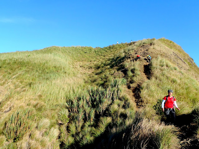
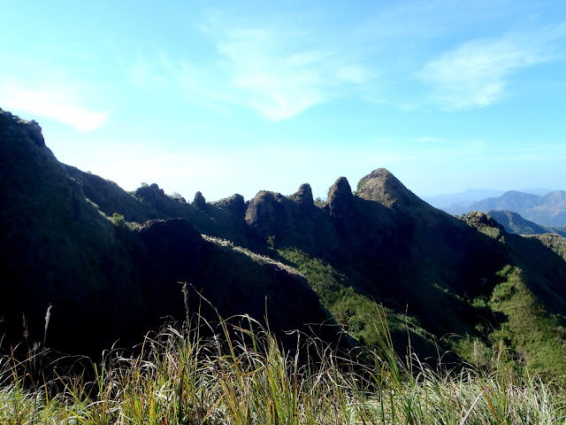
The trails from Camp 1 to Camp 5 are absolutely easy because the management created the steps that you can take to make your trekking comfortable and easy.  In Camp 5, we saw the whole Mt. Batulao Peaks, it's ridges and the grasses shining brightly with the aid of sun rays.  We also had several jump shoots, photos, and  my buwis buhay poses when Ginger and Ian reached the camp 5.  We were like shouting, embracing her and I an and we had a short talk about some personal stuff.  2:57PM we left Ginger and Ian in Camp 5, I an was crying that time because he wants to be with us on the peak, but the trails after camp 5 are very crucial, so we didn't allow them to be with us.

Mt. Batulao
Mt. Batulao
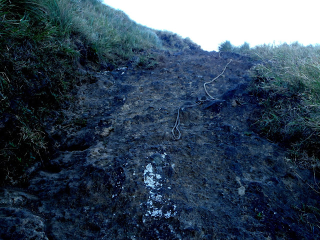
We reached the Camp 8 at 3:14PM, the trail here is much harder.  The wind are much stronger, so we always bend our knees and sit down every time that the wind blows us to prevent accident.  This camp is composed of dusty stone trails which makes the trail hard to climb.  Our shoes slips every time we stepped on the dusty stones.  We also used our hands to balance, we were like doing rock climbing because the trail was really steep.

Mt. Batulao Trail
the assault part - rock climbing

In this Camp 8 we met Gelai and Nil, they are from the 17 participants.  Nil had a cramps in both legs, so they decided to go back. After letting them to take the trail first, we proceeded to the next challenge which is the steeper trail.  We've used the rope tied on the top to balance, but we still used our skills in balancing.  Good thing that we don't have any heavy things inside our backpacks.  After exerting more efforts in the rope, we were creeping on the trail because of the wind.  This time, the wind can blow my slim figure that might result to accident and can even result to death because of the ravine.  We were really slow taking the trail of Camp 8, too dangerous!

At THE SUMMIT

Mt. Batulao
summit Mt. Batulao

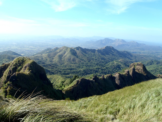
After the horrifying trail on Camp 8, we are now reaching the Peak at 3:31PM.  Wow! I was really amazed on the formation of Mt. Batulao.  I can say, among the mountains that I've been with, this mountain is the perfect in terms of the formation its ranges and peaks.  On the peak, you can see the other mountains nearby Nasugbu, Batangas.  You can also feel the cold wind that blows my black, long  and curly hair.  Despite of the strong wind, we still had a time to do the jump shots, planking and the death defying poses. 

Mt. Batulao
We left the peak at around 3:53PM, so the trail from the Batulao's Peak going to Peak 9 was also challenging.  The trail was so dusty and we were holding and depending at the cogon grasses beside the trail.  The trail was also steep making my legs folded backward and my hands were holding the grass, also in backward position.  I can't stand on the trail going down, because of the main problem which is the strong wind. 


trail Mt. Batulao
After that hardcore trail, at last we've reached the Registration area of the New Trail at 4:36PM.  The registration area also has a store that you can buy everything including  the cold soda and slippers.  All the people needs to re-register and will be paying the 20 pesos fee.  They also have tent and camping equipment for rent!  After taking our rest and fill our empty stomach, we left the area wearing our jackets, because the wind was more cold than during the morning.

Mt. Batulao
Mt. Batulao
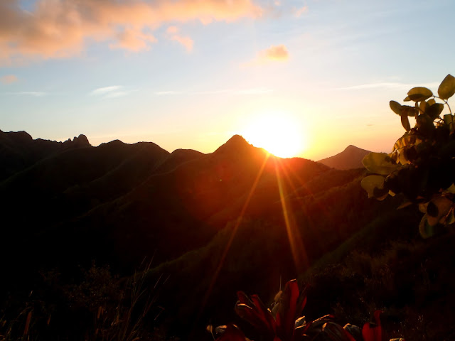
Mt. Batulao really has a lot of Peaks, so by 5:16 we were in Peak 2, much nearer to the base, but wait, the sun is now leaving the ranges and  I saw the heaven turning into orange from blue.  5:29PM, we reached the store selling the halo-halo and buko.  While eating, we were talking about everything that occupies our huge mind.  We also spoke to one of the guides, about the girl fell from one of the peaks and she was 27 years  old.  After 30 minutes, we left the store, and the darkness was beginning to invade the world. 

Mt. Batulao
We double time pacing on the trail, I am sorry to Blogger Claire, because I pressured her to walk faster.  We need to do it because the trail is simple, but it's not good at night because we were lacking flashlights.  At last we did it! before the darkness came, we were able to reach the kabayanan.

Mt. Batulao
Mt. Batulao
Our pacing were still fast, because we need to reach Evercrest as soon as possible.  We still need to eat Bulalo in Tagaytay City and everyone maybe were waiting for us. Claire was really pressured, but she was also fast in walking - two thumbs up!  I think it was already 7:00PM when we reached Evercrest, first thing first? change costume and cleaned ourselves. 

Bulalo Point Tagaytay
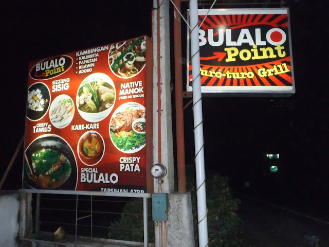
When everything was properly set, at 7:29PM we took a jeep going to Crossing, Tagaytay, worth 25 pesos, so 25x17=425.  We occupied the whole jeepney and as usual, we were so noisy.  I don't know why we're so happy that time, I feel I was so energized that day. 7:46 PM, we reached Bulalo Point in Tagaytay City, the perfect place for our empty stomach.

Since we were17, if I am not mistaken, we ordered 7 Bulalo's, then we included plain rice, and many more. In our group, we were 5, we shared 220 pesos each for our dinner.  It was a windy and cold night in Tagaytay, I wasn't happy on that because I was wearing just shorts.  At 9:07PM we were done eating our sumptuous dinner.

After dinner, time to wait for the bus bound to Manila.  According to some locals, their will be buses passing by until 10PM, so that's fine.  But, it was so cold and I can't imagine that feeling will last for more than an hour.  When we tried to ask some other locals to make sure, and they've said it''s until 11 PM, so which is which?

After more than 30 minutes of waiting for the bus, while we were freezing beside the highway, we did everything just to warm our feeling like putting our palm to our under arms.  At last there was a bus going to Baclaran, but we need to stand up, because the sits can't accommodate our number.  So 5 BHM and Mina remained on the same spot. 

We again waited for more than an hour I think in the same location.  Since I was wearing short, I decided to wear my trekking pants again, I really can't withstand the cold wind. 

I think we need to take another option, so by 10:11 PM we took a jeep going to Pala-pala, Dasmarinas, Cavite with 40 pesos fare,  then we arrived at Pala-pala around 11:00 PM.  From Pala-pala, we took another jeep going to Bacoor, Cavite.  Departure was 11:18 PM then arrival at around 11:50 PM with 27 pesos fare.  And from Bacoor, Cavite, we took another jeep going to Baclaran for only 18 pesos fare.  Departed at 11:53 PM and arived at 12:20 AM in Baclaran.

Baclaran is already part of Manila so I shouldn't worry about my travel, and I already knew how to go home from here.  We first let Sharon and Mina to take a bus going to Novaliches then we took an air-con Bus B going to Cubao, since the Belason brothers will be descending there.  It was 12:25 AM when we left Baclaran, taking an air-con bus.  We-wen was the first one to get-off the bus in Estrella, then me at Ortigas then the Belason bros. at Cubao.  I paid 25 pesos for that trip and arrived at 12:51 AM in Ortigas.

The whole trip was remarkable to everyone!  We've met a lot of new people and friends and we developed a new tie and harmonious relationship.  This Bloggers Climb will not be the last, it will be the start of the new journey for us bloggers and  Mountaineer.
Monday, March 9, 2015

Barasoain Church | Housed the First Philippine Republic

Barasoain Church
 This is part of my "30 Hours Historical Adventure in Bulacan"

On the second day of my Bulacan Historical Adventure, together with Cath, our first destination was the famous heritage site of Bulacan.  It's really a dream come true because I always see this church on the Philippine peso bill. Since it's one of my "What to Visit Place" place since I was still studying the history of the country. And now, after few years, I am finally here.

Barasoain Church is also known as (Our Lady of Mt. Carmel Parish) is a Roman Catholic church built in 1630 in Malolos City, Bulacan.    This church housed the revolutionary congress which was inaugurated on September 15, 1898,  Pedro A. Paterno was the President. It was here, that the congress, among other measures discussed and approved the Malolos Constitution.

What to Visit in Bulacan
Gratefully recognizing the significance of the events that occurred here. The University of the Philippines made a Pilgrimage to this spot and placed this marker on National Heroes day.  The 30th of November in the year of our Lord 1938 and the Commonwealth of the Philippines the 4th.

Republic of the Philippines
The facade has a Neo-Classic touches and its rounded pediment is echoed by the arches and rose window at the lower part.

Barasoain was originally part of Malolos until its official separation on August 31, 1859.  In 1903 it became part of Malolos again.  The old church constructed by Rev. Francisco Royo, O.S.A., was destroyed by fire in May 1884, but rebuilt by Rev. Juan Giron, O.S.A., in 1885.  This church was the seat of the Revolutionary congress which convened from the middle of September 1898, to the last week of February, 1899 under the presidency of Pedro A. Paterno.  Among the important measures passed by the congress was the Malolos Constitution drafter chiefly by Felipe G. Calderon.

First Philippine Republic
It was a temporary residence of Gen. Aguinaldo and this church witnessed three important events in Philippine History: First. the convening of the First Philippine Congress on September 15, 1898 Second. drafting of the Malolos Constitution on September 29, 1898 to January 21, 1899 and Third. inauguration of the First Philippine Republic on January 23, 1899.

What to Visit in Malolos
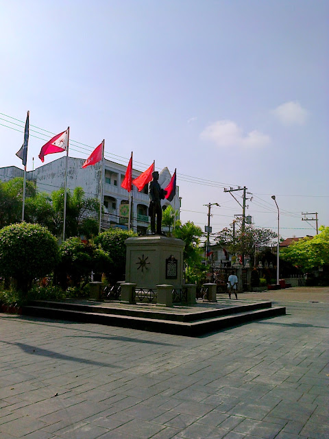
Monument of Emilio Aguinaldo in Barasoain Church

On August 1, 1973 - former President Ferdinand Marcos proclaimed this site as a National Shrine by virtue of Presidential Decree No. 260.

Old Philippine Peso Bill
One Peso Bill Banknotes
Look at the image above, that was the one peso bill banknotes issued by the Central Bank for the Philippines during the Presidency of Diosdado Macapagal.  Barasoain Church can be found at the back of this banknotes.  We laso have the ten peso bill that has the Barasoain Church image at the back - that means, Barasoain Church played a big role in creating the very first Republic of the Philippines.

Barasoain Church is fifteen minutes jeepney ride from Bulacan Capitol and 100 meters away from Casa Real Shrine, and is on the same way going to Malolos City Hall.

Sunday, March 8, 2015

Mt. Pulag and the Sea of Clouds

Mt. Pulag
Among the mountains that I was able to hike, Mt. Pulag is one of best in terms of beauty and experience. The famous “Sea of Clouds” is another feature that this mountain can be proud of, so if you’re on the summit, you’ll feel that you’re above the clouds; please refer to the photo at the bottom

Mt. Pulag is considered as the highest point in Luzon that ranges 2,922 MASL and in the Philippines. If you’re from Manila, Baguio City is the major drop off point to reach the jump off area of this gigantic mountain. But while on the way to it's jump off, you'll experience amazing journey. Read the details below:

Ambuklao Dam
From Baguio City, we chartered a jeepney going to DENR to process our registration and to attend the seminar. DENR officials conduct seminar to make sure that all the hikers are aware of the MUST DO and MUST NOT DO, especially the Leave No Trace principle.  But while on the way to DENR, we witnessed an amazing environment of this area. Instead of placing our stuff as top load, we placed them inside the jeep and we occupied literally on the top. I can’t forget the feeling while the cool wind blew my curly hair and our eyes were full of gorgeous sceneries.

Benguet Terraces
We passed by the stores and cafeteria along the way; took a rest and had our breakfast. After DENR, next part was the exciting zig-zag road to the Ranger Station, which is the jump off point. This part, the road contains a lot of left and right turns which added an amazing experience to the traveller; by the way, we were still on the top load this time. What we saw were the plantation of carrots, radish and other vegetables, which serve as the main source of income for the locals, on their man-made rice terraces.

It was around 1:30PM when we reached the Ranger Station and then processed our guides and porters. In processing those, policies are involved like weighing hikers load. In Ranger Station, stores and rest rooms are available. The wind was really cool.
 
Trail in Mt. Pulag
After the Ranger Station will be the start of trekking. The trails going to the summit of Mt. Pulag are well established, because they are maintained by the management. A lot of hikers are interested to experience the famous “Sea of Clouds” will be another reason. First part is trekking the trail surrounded by pines, grasses and mosses. There are trail marks and stations that hikers can follow to prevent loosing on the right track. Again, DO NOT THROW your garbage in any part of the trail/mountain. DO NOT pick or remove any plants on the trail, LET THEM LIVE. Just to inform you, there are trails that hikers can choose from, Ambangeg Trail is advisable for the first timer.

Camp Site in Mt. Pulag
 Next part will be the grassland, it is where you’ll see nothing but grass, that’s why they call it “grassland” make sense right? It is also the area where the temperature is much lower because of the altitude; so therefore my breathing was also affected by that factor. This is one of the best parts in hiking Mt. Pulag, because this is where the shadows of the ranges and the gorgeous slopes can be seen. You'll also can see the other mountains nearby, covered by the clouds. From afar, the trail on the grassland looks amazing, look on the photo above and right. 

Ito yung part na kung saan habang kausap ko yung kasama ko, pero hindi namin namamalayang may tumutulo na palang sipon sa mga ilong namin, dahil sa malamig na hangin at fog. By the way, with regards to the trail, there are parts where trail foundation is weak because of  the grass, so please be careful. Trails were also modified, the management placed rocks and stones on the some parts to make sure that hikers are well protected from untoward incidents.

Photos above show how colorful the camp site was during our hike, a lot of hikers were there. At the camp site, there is an area which serves as the rest room, but just to set your expectations, it's not that modern like we have in hotels. Another reminder in camping, please DON'T throw your spoiled/leftover foods near the camp site, because it will attract insects. PLEASE BE CAREFUL WITH FIRE - Camp site is really cold, yes! But there are times where the grasses are dry, so it means it can easily burnt.

Sea of Clouds in Mt. Pulag
The unforgettable part of this hike was to witness the "Sea of Clouds," photo above. It was around 5AM when we woke up and proceeded to the summit to see this spectacular event. According to the other hikers, last night the temperature went down to 5 degrees celcious, so imagine how hard for us to wake up that time. The cold wind was like a spear when striking in any parts of my body. Kakalowkang lamig talaga.

From the camp site to the summit, it took us more than 20 minutes and I know you'll be asking why, it's because from the camp site up to the summit, the trail was full of hikers. Hindi kami makatakbo paakyat para at least mabasawasan ang lamig na aming nararamdaman, pero hindi talaga pwede.

After experiencing those challenges, while the sun was rising, we were astounded by everything! On the summit of Mt. Pulag, you can see the gorgeous cloud formations, the artistic slopes of the mountain ranges from afar and the grassland appears like a playground. The color of the horizon was the mix of gray, blue and gold; seems to be perfect for a photo background. Kakaiba talaga yung feeling kapag nasa taas ka ng Mt. Pulag, hindi ko maipaliwanag sa salita, kailangan nyo talaga itong maranasan.

THINGS TO REMEMBER:

Registration to the DENR IS A MUST.
Leave No Trace Principle must be observed.
Mt. Pulag has a freezing point; jackets, gloves and warmer are advisable.

Friday, March 6, 2015

Giant Lantern Festival


Giant Lantern Festival

Brief History:

The Giant Lantern Festival is an annual festival held in December (Saturday before Christmas Eve) in the City of San Fernando in the Philippines. The festival features a competition of giant lanterns. Because of the popularity of the festival, the city has been nicknamed the "Christmas Capital of the Philippines".

The first lantern festival was held to honor President Manuel L. Quezon. At that time, Quezon made Arayat his rest area and converted Mount Arayat into a tourist resort. As a show of gratitude to Quezon, the people of San Fernando held a Christmas lantern contest to honor the first family. Quezon himself donated the prize for his lantern contest, which was personally awarded to the winner by First Lady Aurora Aragon Quezon -WikiPedia.org

December 15, 2012, right after our Mt. Manalmon adventure, in Bulacan, we had a side trip to Pampanga, just for the annual "Giant Lantern Festival" and of course because of Beth's invitation.  But, unfortunately she's not there due to some problems.  We were seven in the group who witnessed the gorgeous lanterns and each lantern representing it's Barangay for different category.  Each lantern measures 20 feet and have hundred or even thousand of lights bulbs.  The lanterns were really gigantic and the people behind it exerted a great effort just for the title and to give happiness to every people.  Want to see the video??


Since we arrived at 8:16PM, we missed 3 lanterns, because the program started at around 7PM, so next year, I don't want to be late again. In that single event, there were thousand of people from different places enjoyed the dancing lights which was really stunning in the night.

The organizer made this event into a world-class Festival that every people should see every year.  So, next year, I am just hoping that I still have time for this huge event in Pampanga.

Congratulations to our 2012 Giant Lantern Festival Competition (Ligligan Parul) Winners! :D

Grand Champion: Brgy. Del Pilar Giant Lantern
1st Runner Up: Brgy. Telabastagan
2nd Runner Up: Brgy. San Jose

Tuesday, March 3, 2015

Bagac Bataan and it's History

Bagac Bataan
May 18, 2012 was my fist step in the province of Bataan.  I was in high school when I heard this province, included in Philippine History during the Japanese colony.  Bataan is one of the provinces which played a huge part in country's heritage; from the famous Mt Samat, Death March and the old churches can be found in here. 

Bagac, Bataan - is located on the western side of Bataan which is 151 kilometers from Manila (Philippine's Capital) and 27.82 kilometers from the provincial capital - Balanga.  This Municipality is composed of 23,120 hectares or 16.84% of total Bataan land area.  It covers 14 batarangays: Bagumbayan, Banawang, Binuangan, Binukawan, Ibaba, Ibis, Pag-asa, Parang, Paysawan, Quinawan, San Antonio, Saysain, Tabing-Ilog, Atilano Ricardo.  It is also the biggest town in terms of land area in Bataan.

HISTORY
According to my research, during the arrival of the Spaniards in the Philippines, some of them (together with the Aeta's) were traveling along the seacoasts without any fixed direction when they pass between two sharp points extended to the sea.  The Spaniards asked the Aeta's if what the name of that place, Aeta just answered, we call it "lumbak" which means lying between two hills.  When their ship pass accross that place they saw a flock of herons flying above them, and again the spaniards asked the Aeta if what is the name of that white birds, Aeta replied: "Iyon po ay ang ibong tagak" - meaning Tagak is the name of that bird.  So, as the time passes by, from "Lumbak" and "Tagak" came with the words "bak" and "gak", and it bacame Bagac. 

What to visit in bagac bataan
TODAY
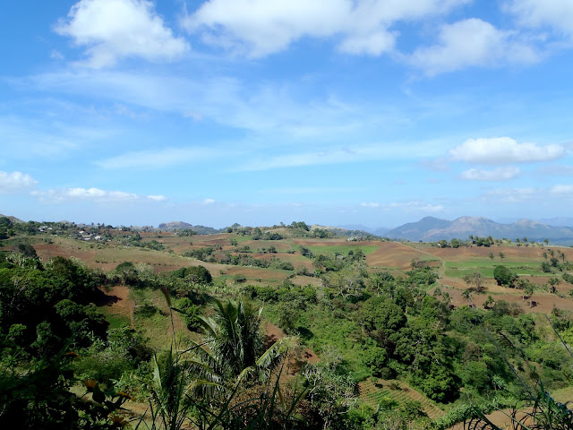
Bagac is an agricultural and aquatic area; while other municipalities and provinces are converting agricultural land into other uses.  The Municipality of Bagac is now preserving those land area to be nurtured.  The coastal areas are the primary source of seafood and the shore line was converted into resorts bringing thousands of tourists each year, especially summer.  Bagac is also rich in rainforests, caves, waterfalls, coral gardens and the World War II Japanese shrines which are the destinations of those nature lovers.

bagac tower

BAGAC TOWER
This 27-meter (89ft) tower was constructed with the help of the Japanese government to symbolize the renewed peace and friendship between two countries.  Located about 200 meters from where the Death March started; and was inaugurated on April 8, 1975.  It is composed of three pillars interconnected by several multi-layer rings. Located at the crossing of the Gov. Linao National Road and the road to Bagac Town proper.

visit bataan

noth philippines

where to stay in bataan

Where to eat in bataan

backpacking in the north
Here's the Video from the Bagac Falls
 
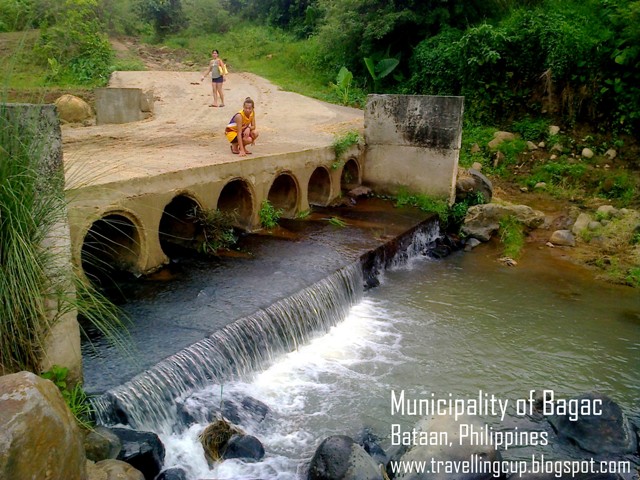
How to get here? Here's what we did | We took a bus at Genesis Transit Terminal in Cubao going to Balanga Terminal (more than 3 hours travel).  Then, we took a mini bus going to Bagac Tower. At the side of the tower, tricycle is available, just give the address to the dirver and they will bring you there.

Sunday, March 1, 2015

Kanidugan Festival

Romblon Festival
I am now living here in Manila for more that five years now, and in every single year, I make sure to visit my home town in Odiongan, Romblon.

One of the most awaited and special day of our town is our very own annual festival.  This festival is dedicated only for all the Odionganons.

Kanidugan Festival (Coconut Festival which derived from a word “Nidog” or Niyog in Filipino or Coconut in English) it’s an annual festival celebrated in every month of April, foundation day of Odiongan and to honour Saint Vincent Ferrer (the patron saint of Odiongan, Romblon.) 


The Municipality of Odiongan, celebrates this special day in the whole week, started by a Biniray (fluvial parade) in Brgy. Tabin-Dagat on the first day; PASAGUDAR (dancing and party all night) on the second day; the civic affairs celebrates Miss Agency on the third day; Miss Odiongan Coronation Night is holding every fourth day of the week; then followed by Kanidugan Festival street dancing competition on the fifth day and on the sixth day is the entertaining boxing game including the local’s famous GayBoxing Event,and on the last day of the week will be the most anticipated “Miss Odiongan Rose” or the Miss Gay Pageant which makes the town plaza super crowded.

what to visit in romblon
Marble Capital
Coconut Festival
festivals in the philippines
coconut in the philippines
Kanidugan Festival
tourist spot in romblon
romblon
southern tagalog


HOW TO GET HERE:
Tablas Airport is the gateway to the province by plane. Airphil Express and Sea Air have a regular fly from Manila to the airport located in the Municipality of Alcantara, Romblon.   From there, as part of the services offered by the Airport, they put a van going to Odiongan.  Travel time would be less than 1 hour and 45 minutes.

Batiano Port is also the gateway to Odiongan.  From Manila: any Provincial Bus Stations going to Batangas Port, Batangas City, go to Terminal 3.  In Terminal 3, you can see various ticketing outlets, and in every window, there is a location displayed, so just select the correct one.  I suggest you take Montenegro Lines; they have schedules every 4PM every day.  Travel time would be 8 to 10 hours.  When you reach the port, just go to the gate and then take tricycle (just tell the driver to bring you to any resorts nearby.)  Drivers are hospitable too, they will take you to the best resort.

 
WHERE TO STAY:
In Odiongan, you can enjoy everything; you just need to leave your problems in your workplace.  Since Odiongan is now starting its tourism campaign, business sectors focus on how to entertain tourists.  As such, they now building a unique and elegant Hotel located near the gate of Batiano Port, along the shore of Poctoy are the low budget Resorts but they offer universal services, and the Rencious Resort located in Brgy. Liwanag is one of the top picks.